
Ozark Highlands Trail (OHT)
17 free downloadable topo maps of the OHT.
Printed maps are also available for purchase.
Skip the trail descriptions and jump to the topo maps
The entire trail is now available for Google Earth.
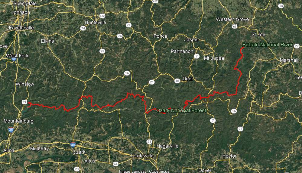
Background. It used to be said that the Ozark Highlands Trail (OHT) was 165 miles long, stretching from Lake Fort Smith State Park to Woolum Ford on the Buffalo River. Now it is a little more complicated. First, on the west end Lake Fort Smith and Shepherd Lake were combined into one, Lake Fort Smith State Park was moved 4 miles north and the old trail was flooded. A new trail section connects the new park with the existing trail in Jacks Creek. According to the GPS track we took April 17 2009, it is a mile shorter.
Making it up at the other end is the east section of the Buffalo River Trail and the new Sylamore Section of the OHT. The east section of the BRT is dozens of miles from the terminous of the west section at Pruitt AR but it is mainly in the boundary of the Buffalo National River. The original 165 miles of the OHT ends at Woolum, where the east BRT begins. As a consequnce the east BRT is also cnsidered part of the OHT. No matter the name, the east BRT runs another 15 miles to the US Highway 65 bridge across the Buffalo River.
Another 30 miles to the east as the crow flies is the Sylamore section of the OHT. Though far from being contiguous with the existing trail at Woolum or Highway 65, this 31.6 mile trail is officially part of the OHT. Both the east BRT and the Sylamore Section of the OHT will be part of the Trans-Ozarks Trail (TOT). When complete, the TOT will combine the Ozark Highlands Trail, the east BRT, the Ozark Trail of Missouri and many trails still to be built, to connect Fort Smith AR and St Louis MO.
This page will focus on the original 164 miles from Lake Fort Smith to Woolum on the Buffalo River.
Trail Descriptions: The following links will give you descriptions and pictures of selected sections of the trail.
- Fort Smith State Park to Cherry Bend (Maps 1, 2, 3, and 4)
- Cherry Bend to Morgan Mountain (Map 4)
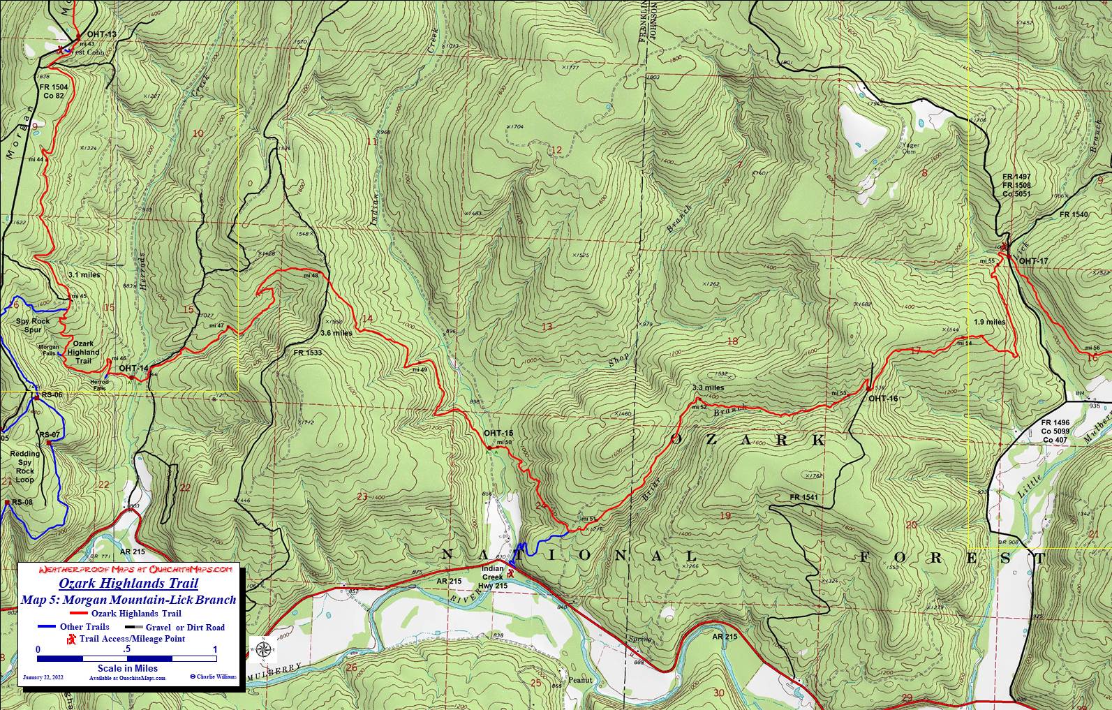
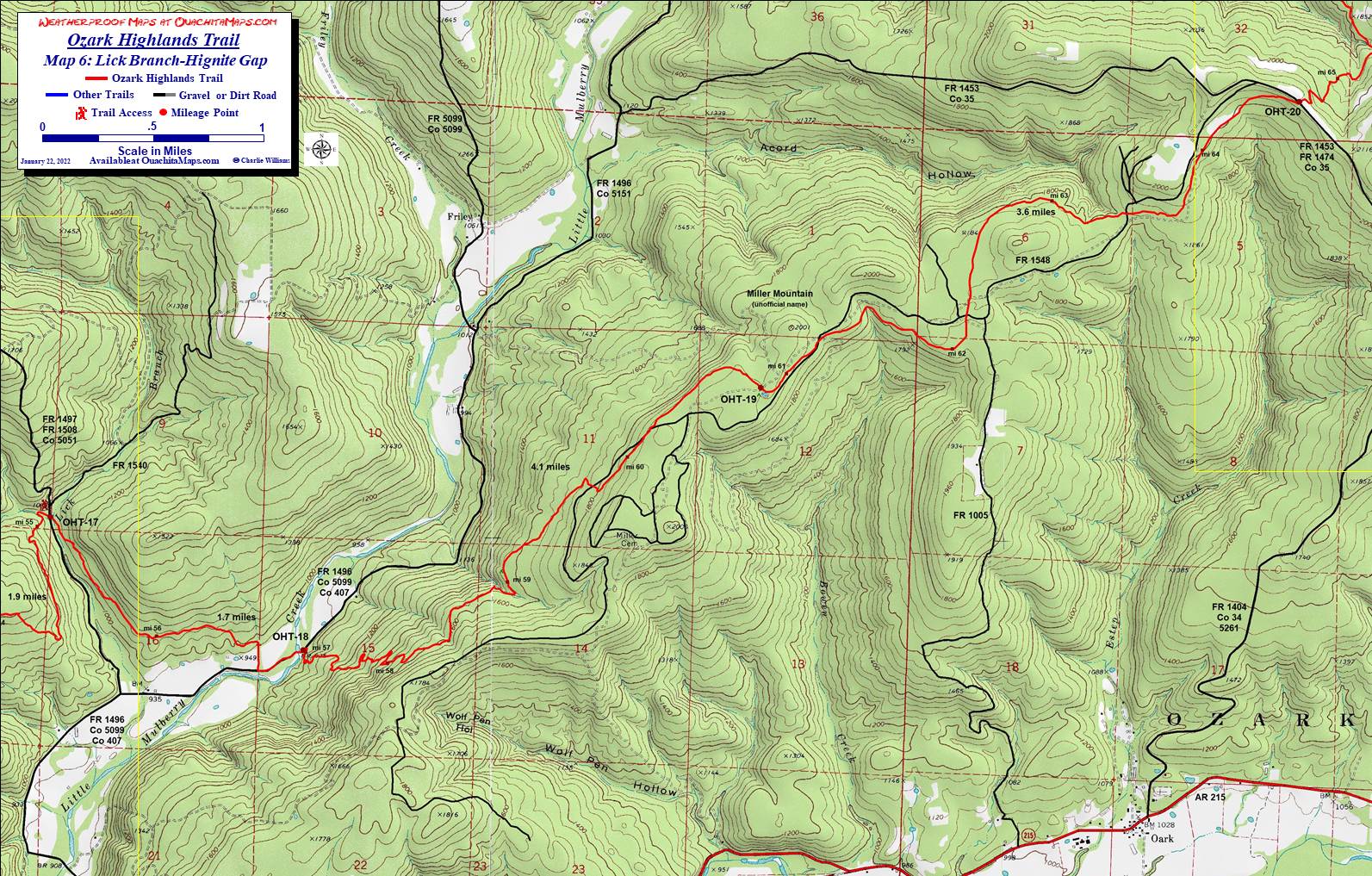
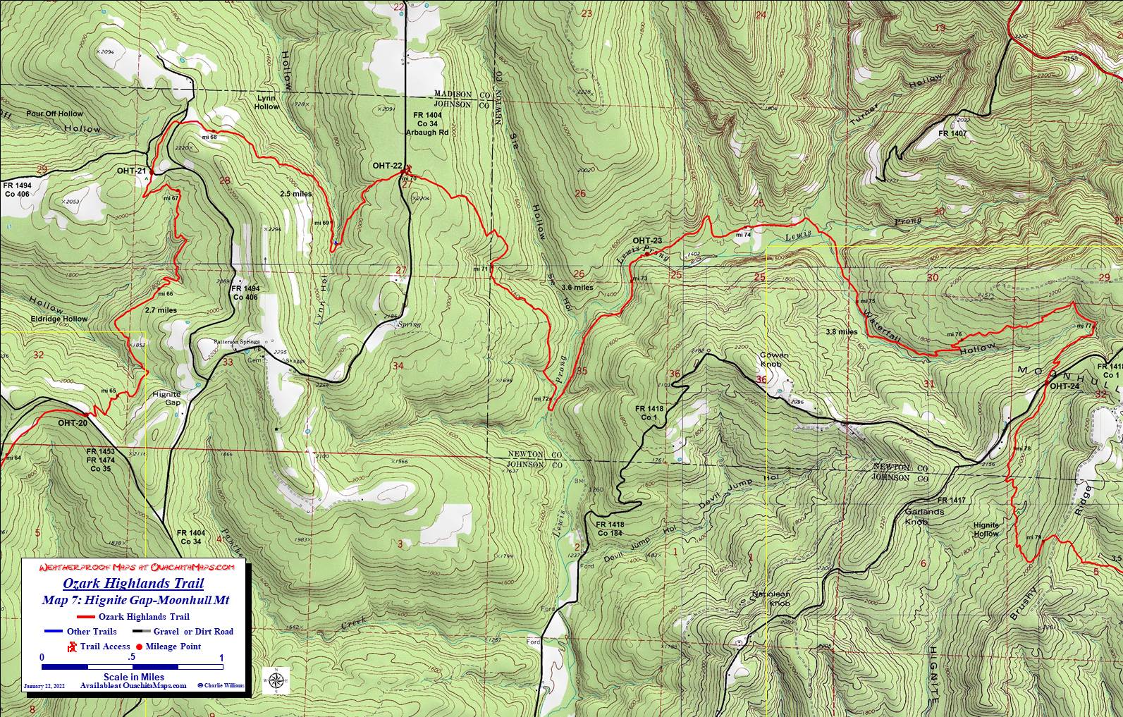
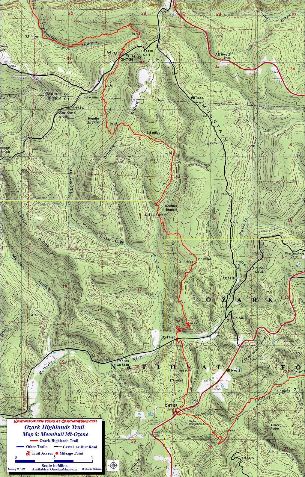
- Morgan Mountain to Ozone (Map 5, 6, 7 and 8)
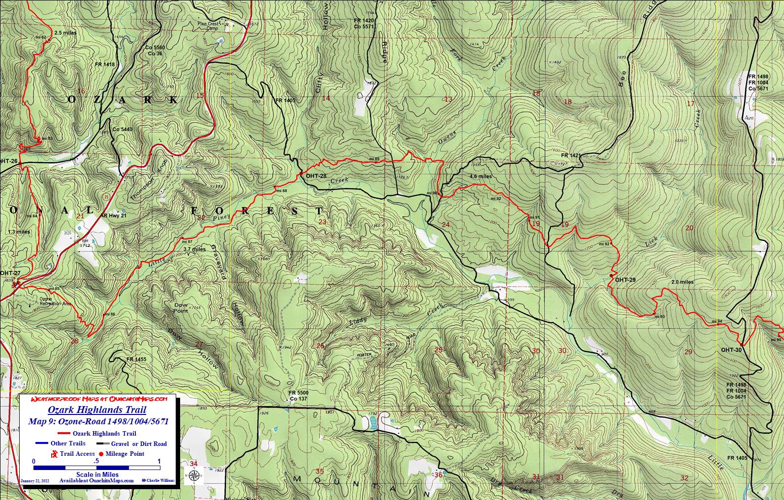
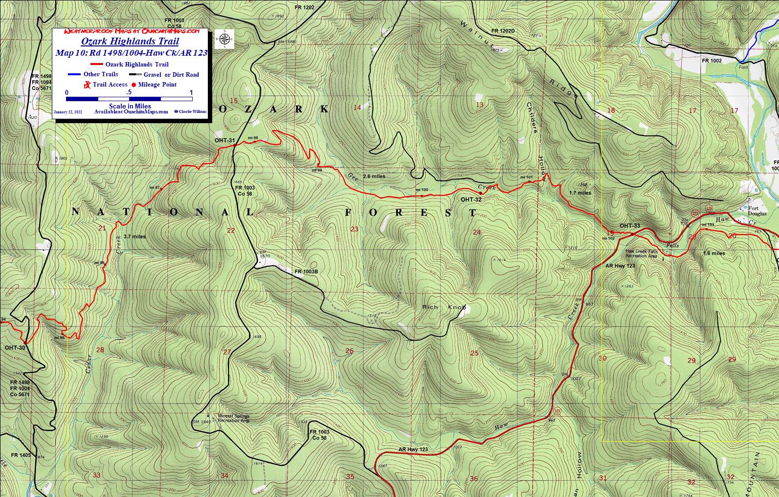
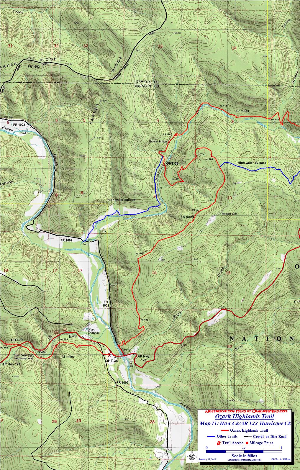
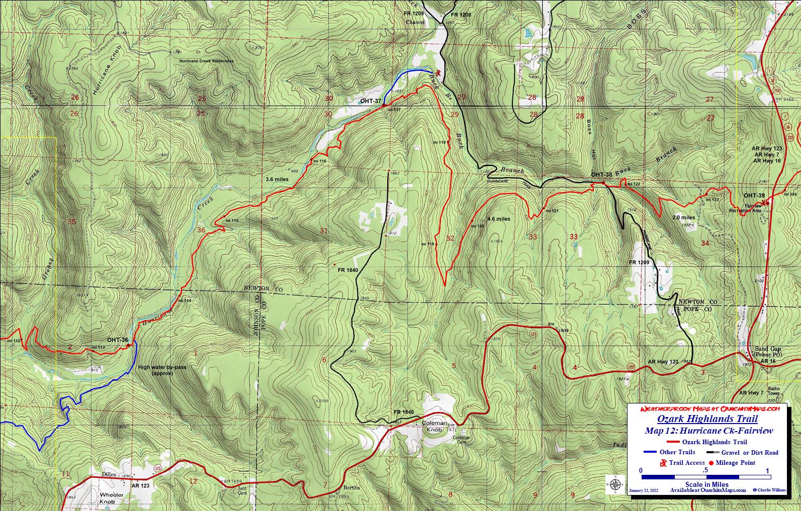
- Ozone to Fairview (Maps 9, 10, 11, and 12)
- Fairview to Woolum (Maps 13, 14, 15, 16 to 17)
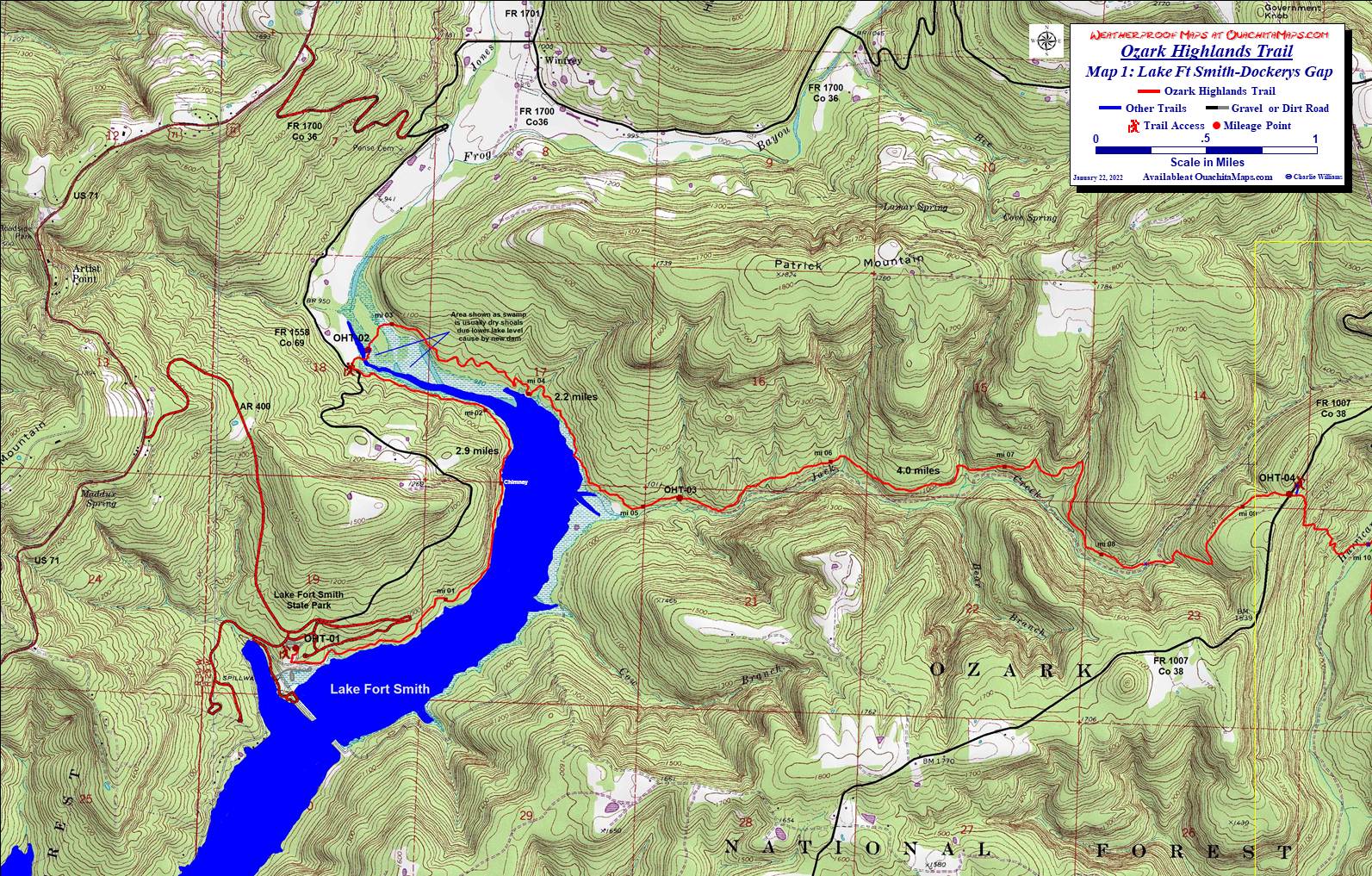
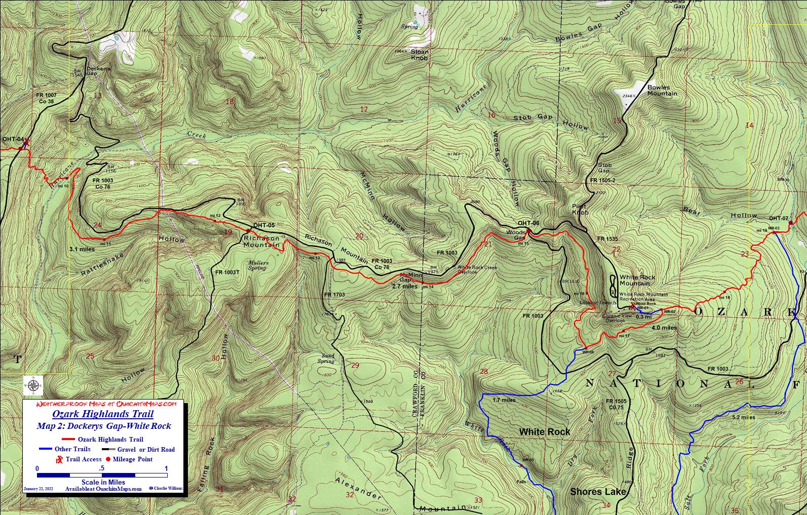
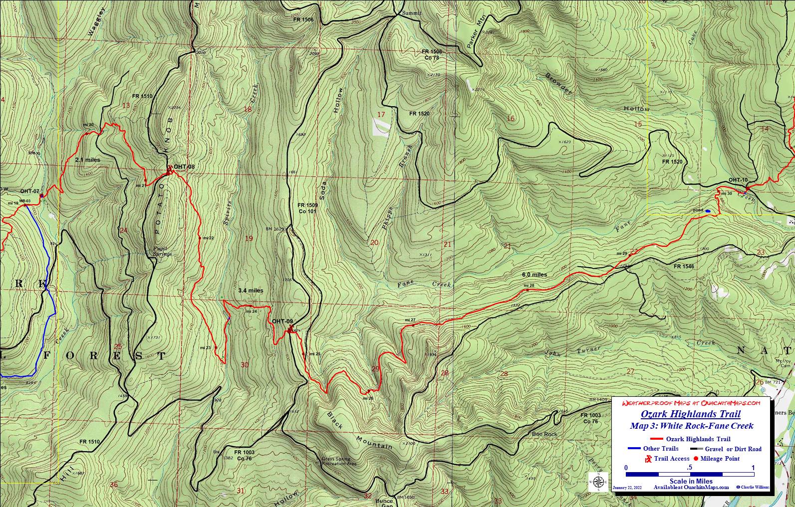
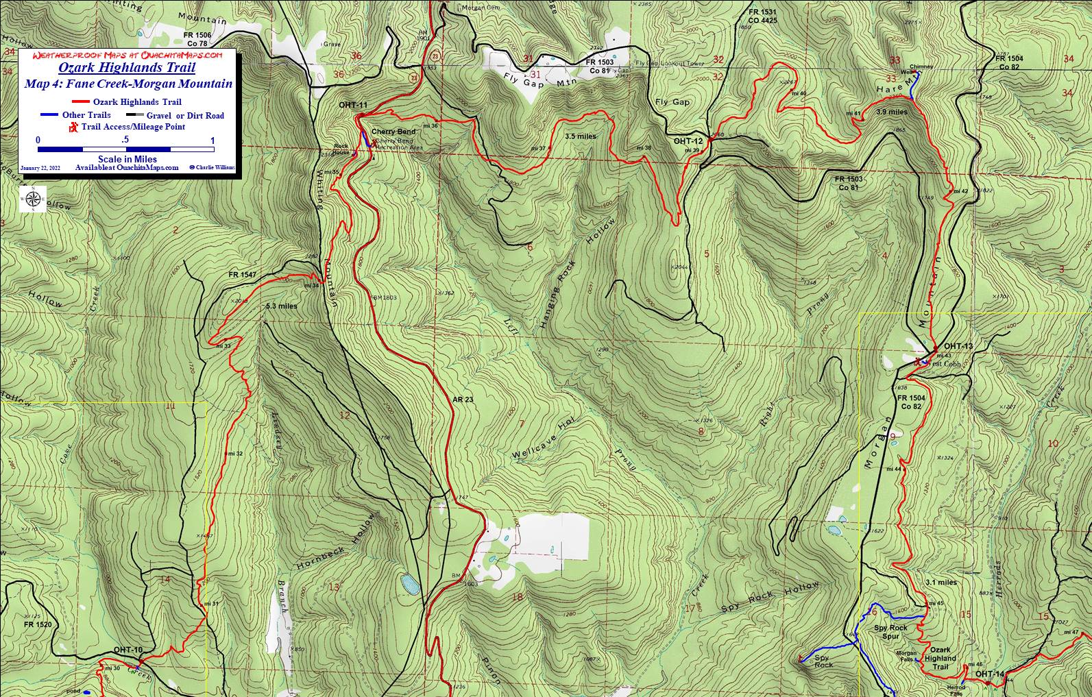
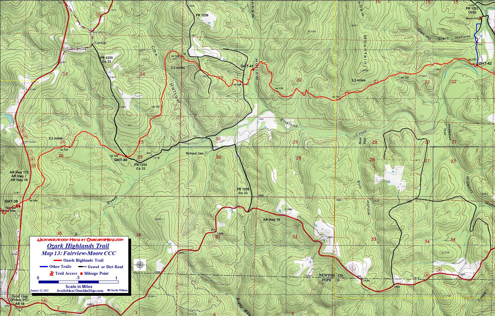
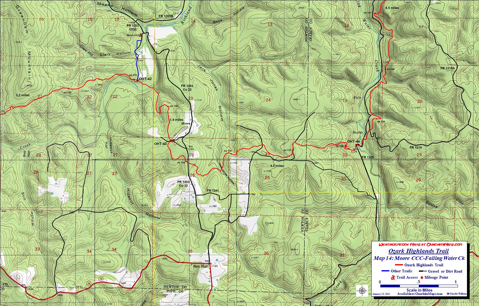
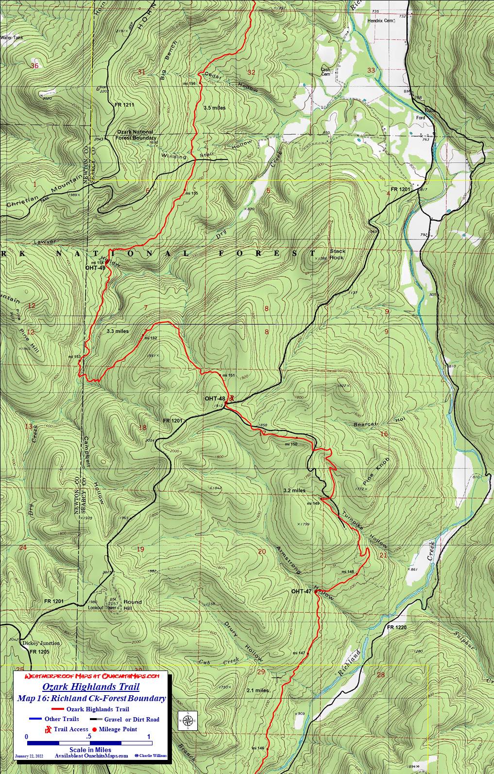
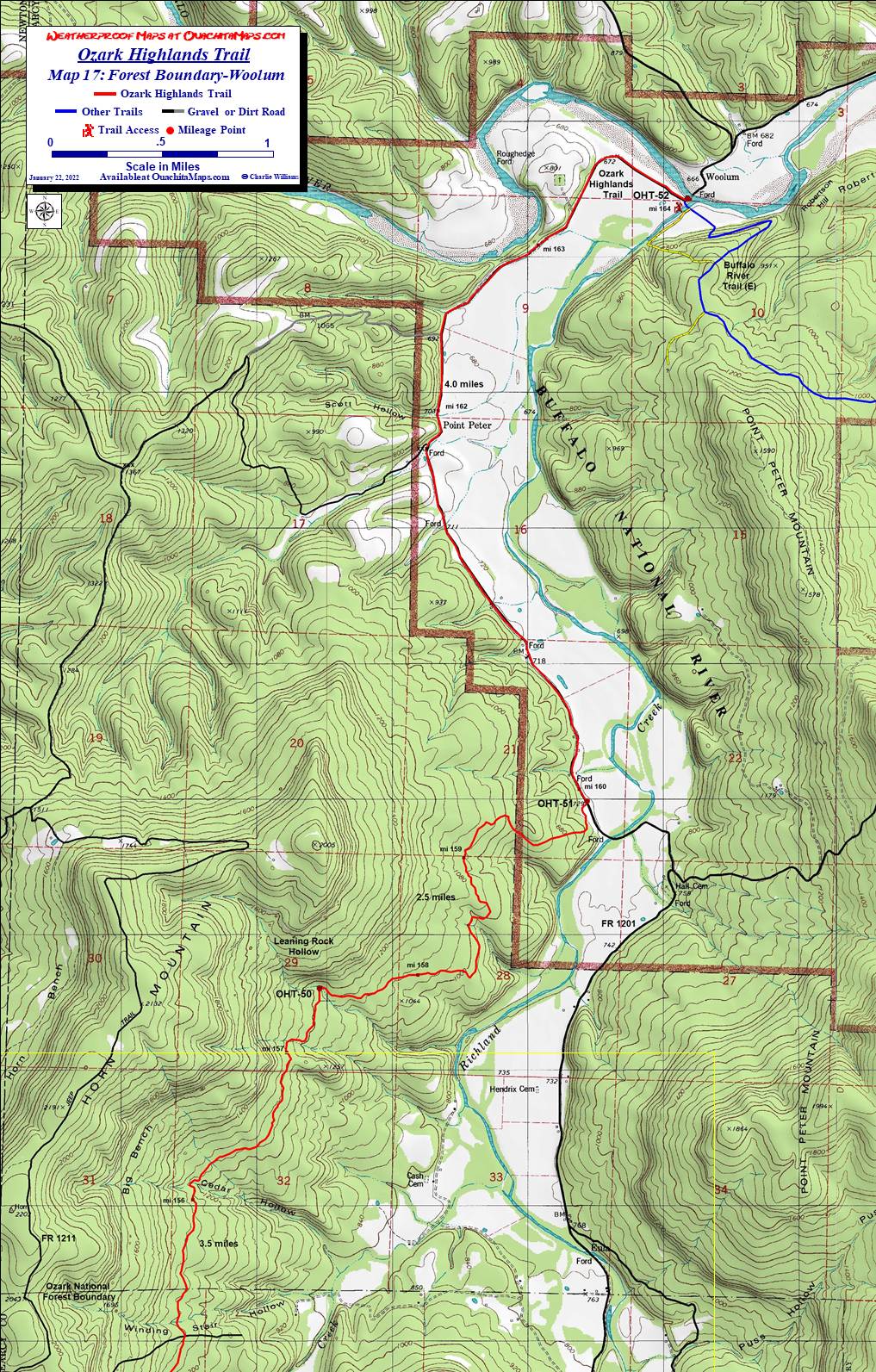
The Maps. The 17 detailed topos are a little further down the page. They begin at the new Fort Smith Lake State Park and stop at Woolum. The maps are free downloads that are formatted to print at scale (1:24,000) on 11 x 17 paper. Click on the image to get to the full size map and right click to download. It is free! Alternatively, you can purchase the same maps printed in color on weatherproof, Rite in the Rain, 11 x 17 paper (see bottom of page).
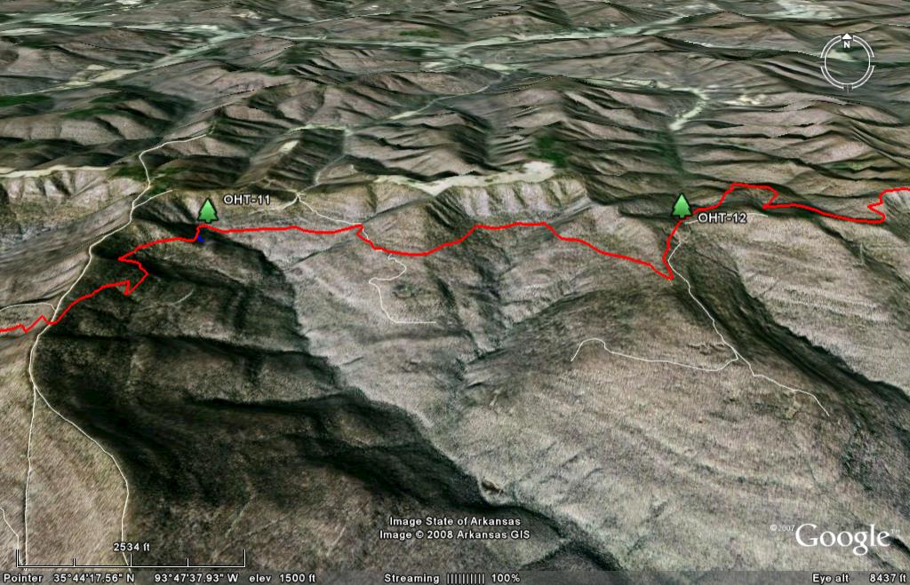
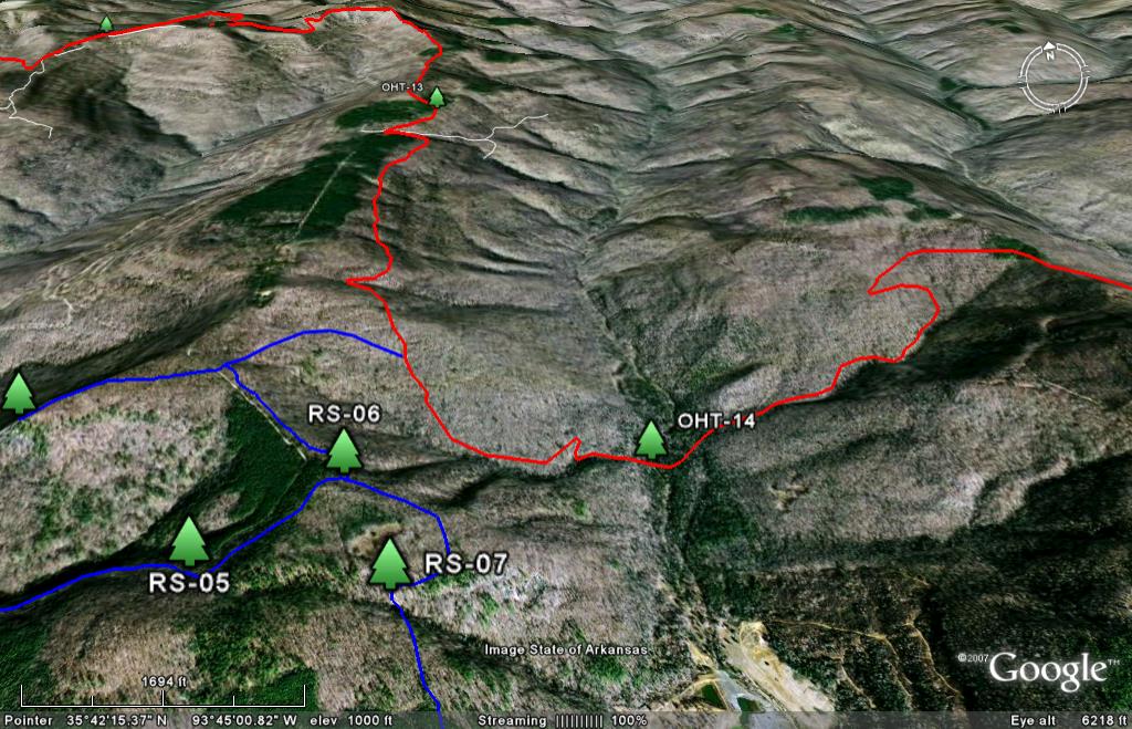
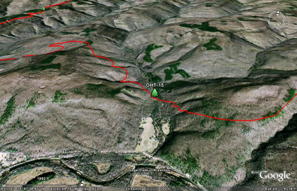
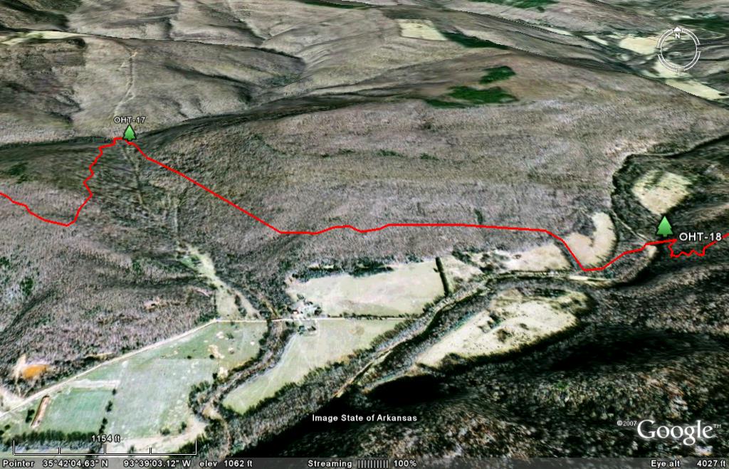
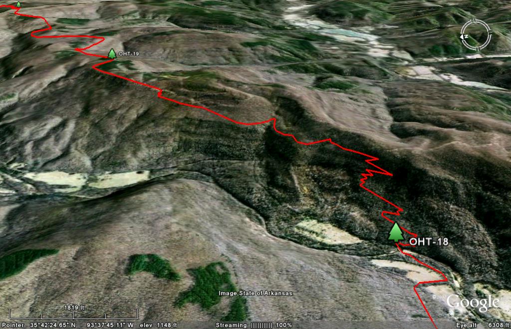
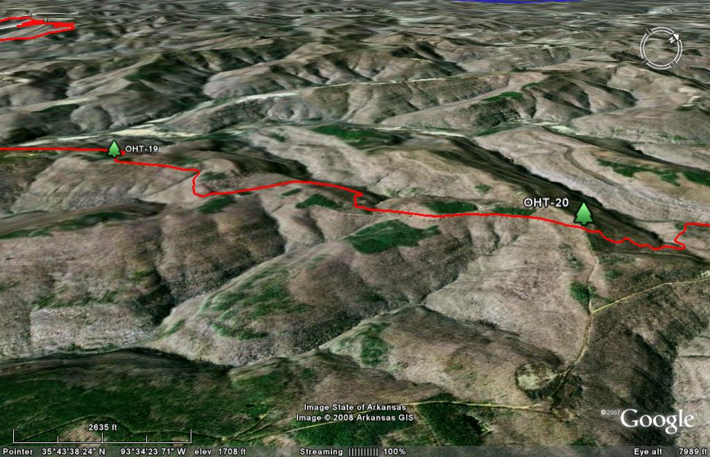
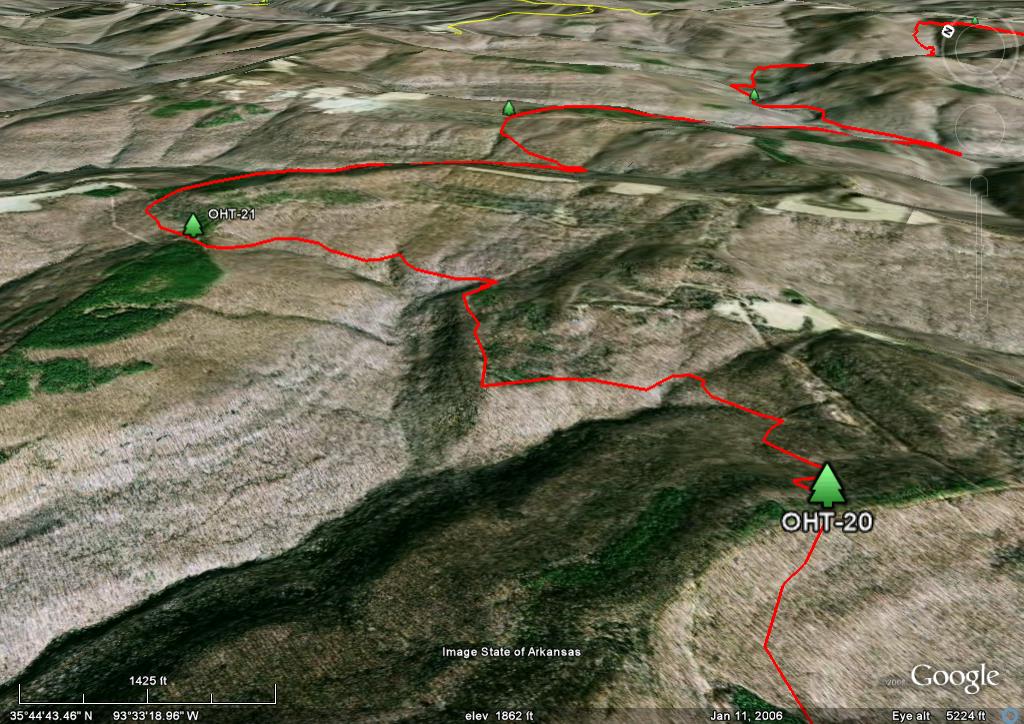
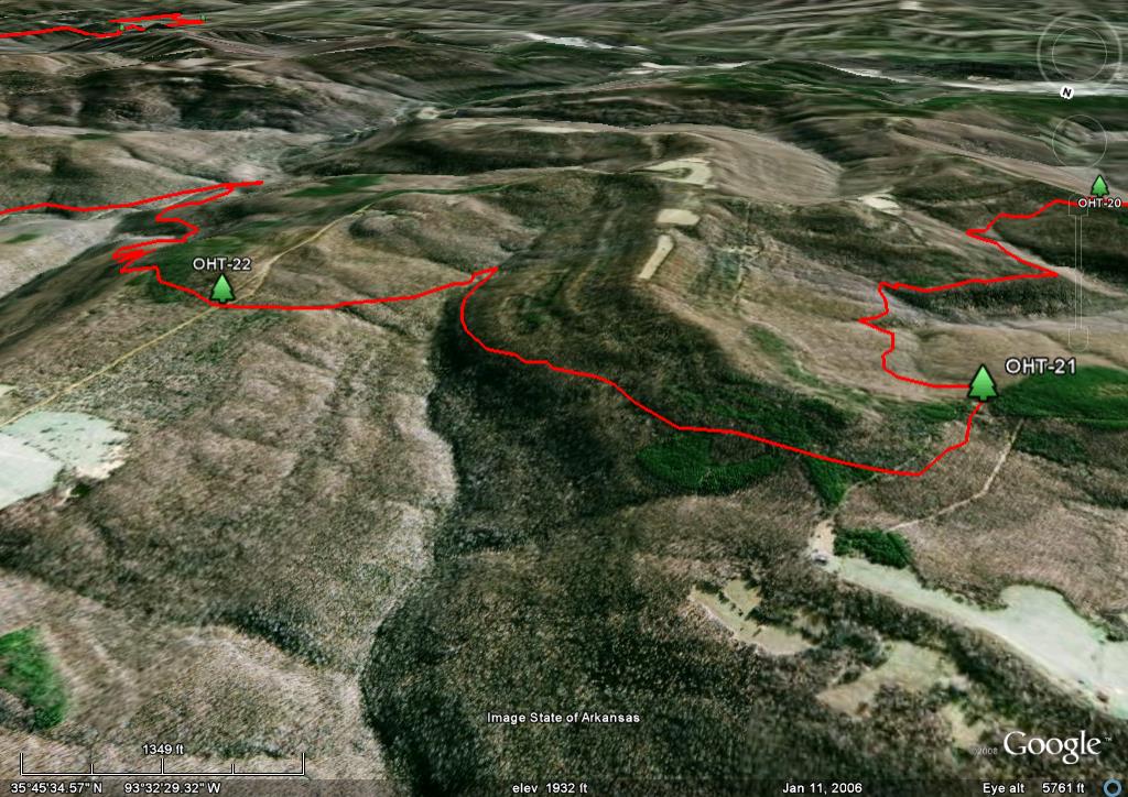
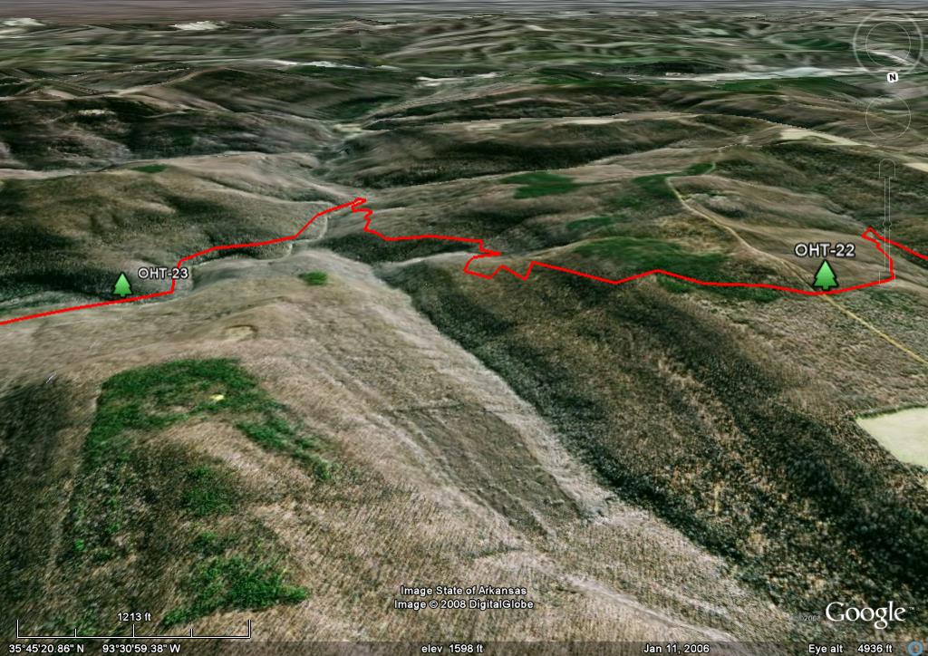
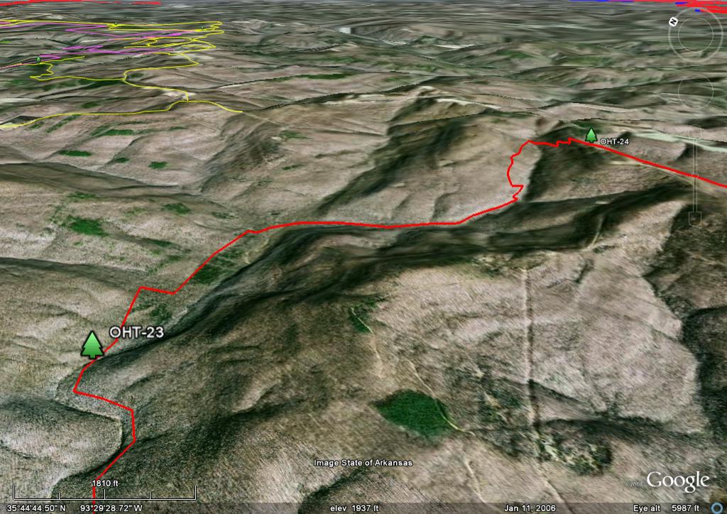
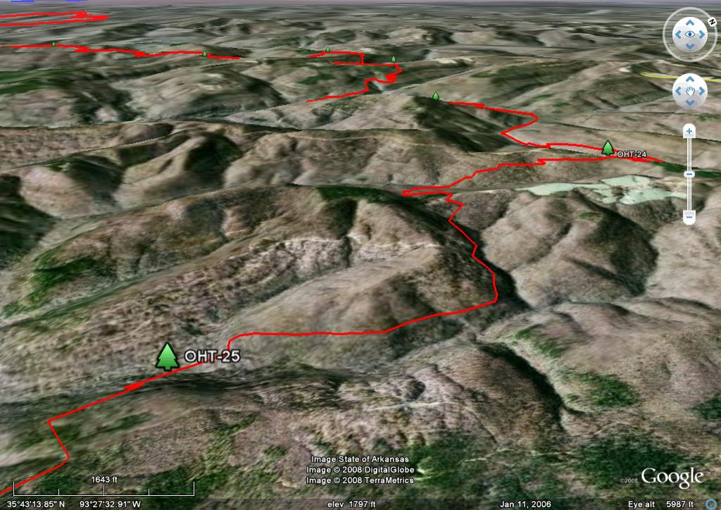
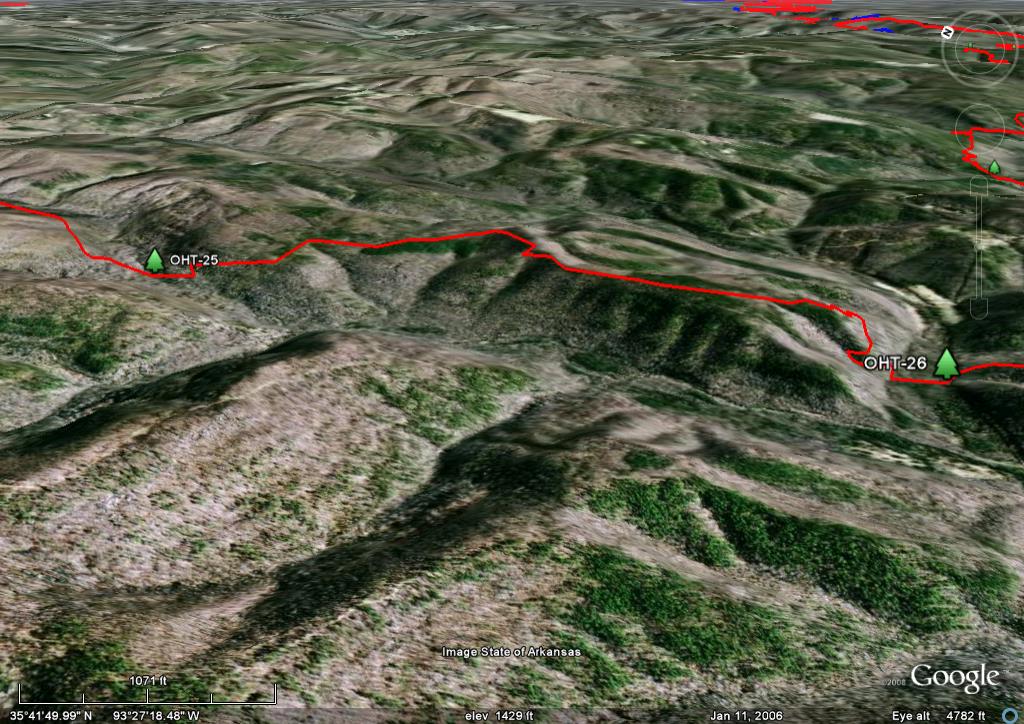
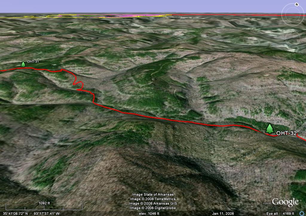
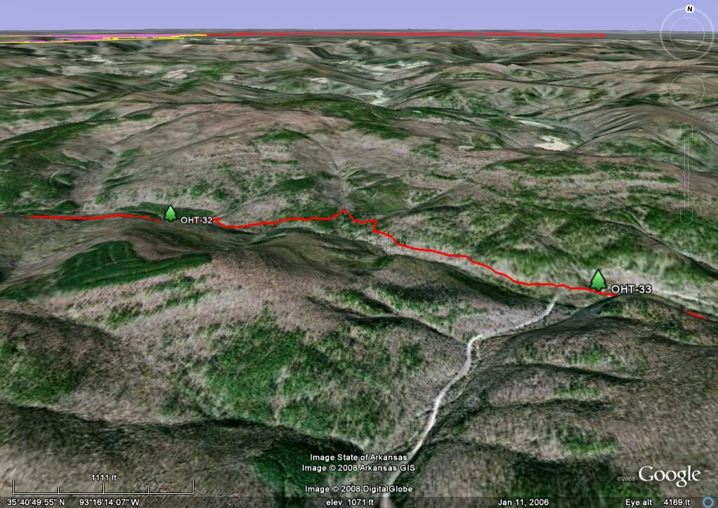
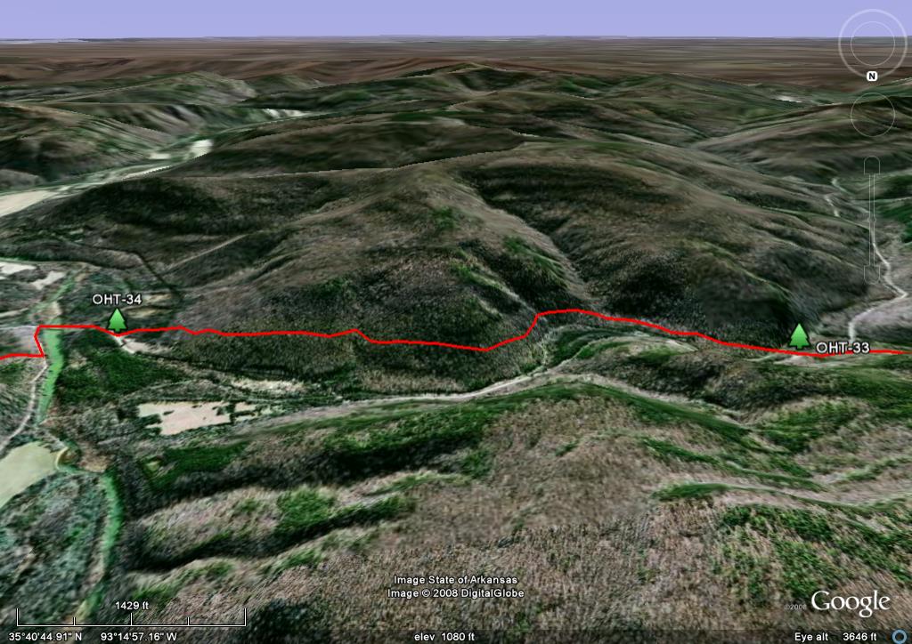
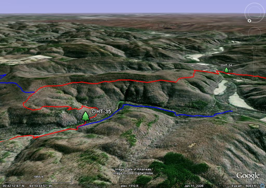
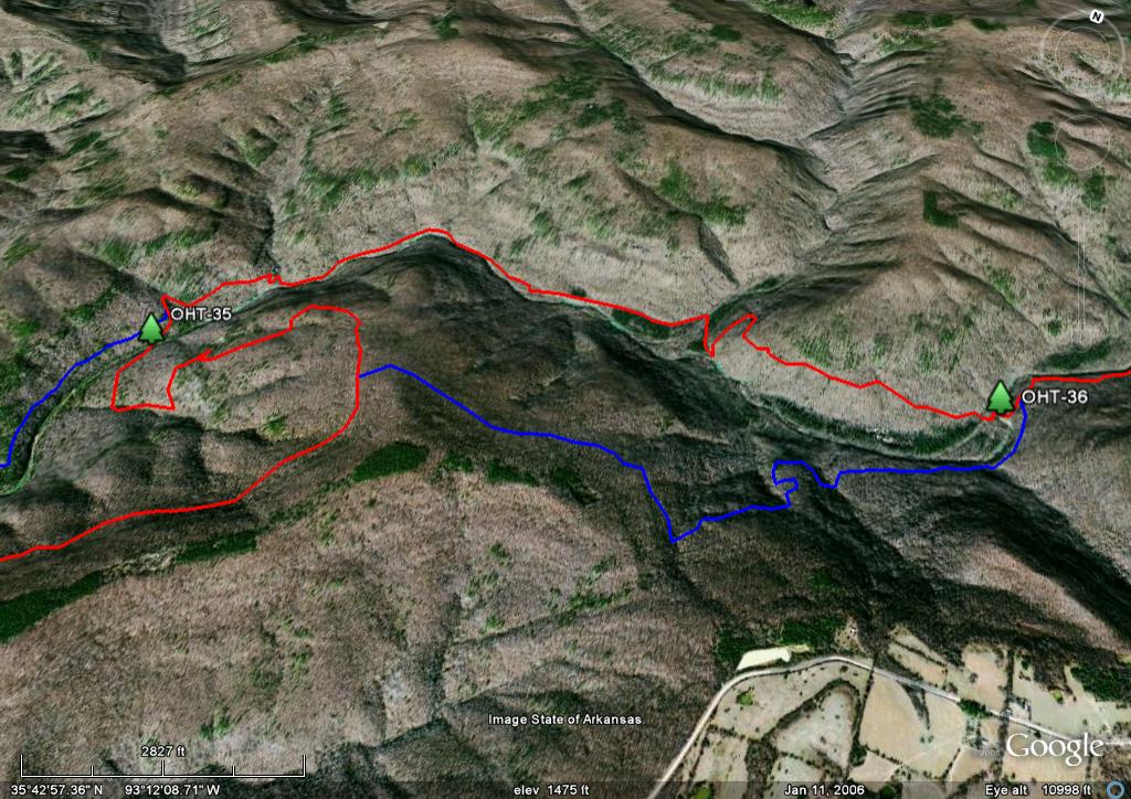
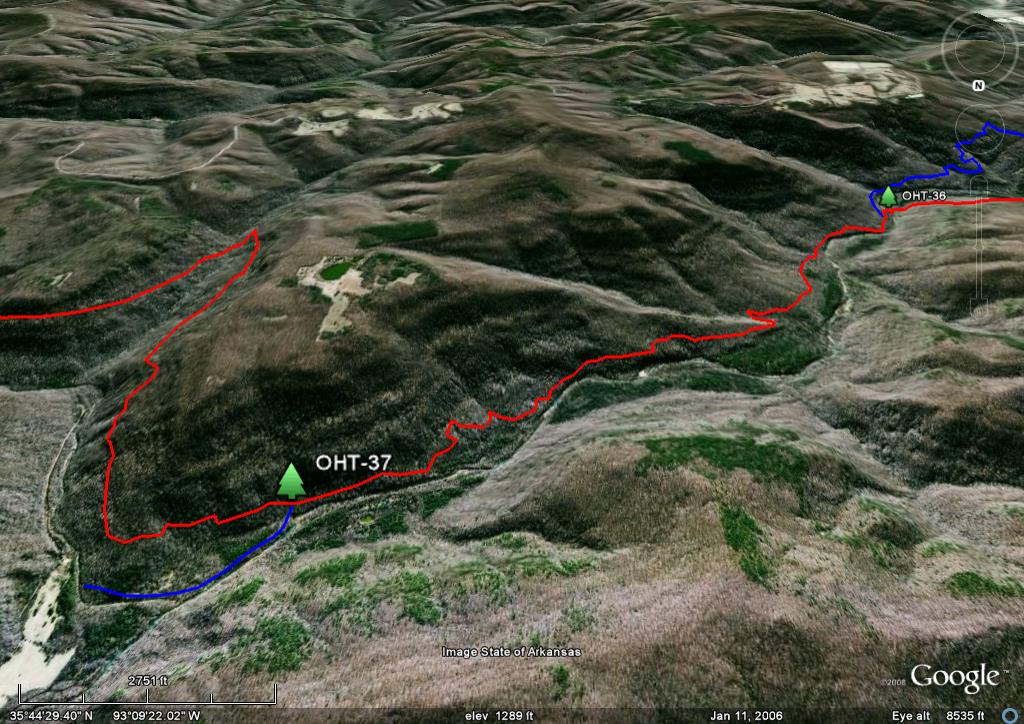
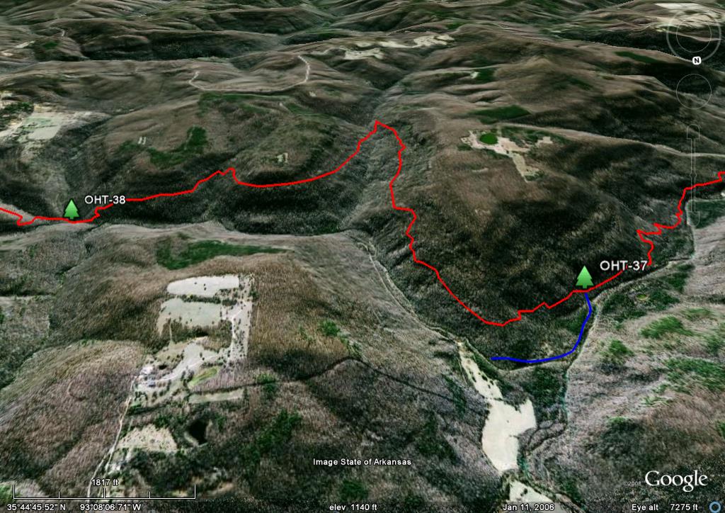
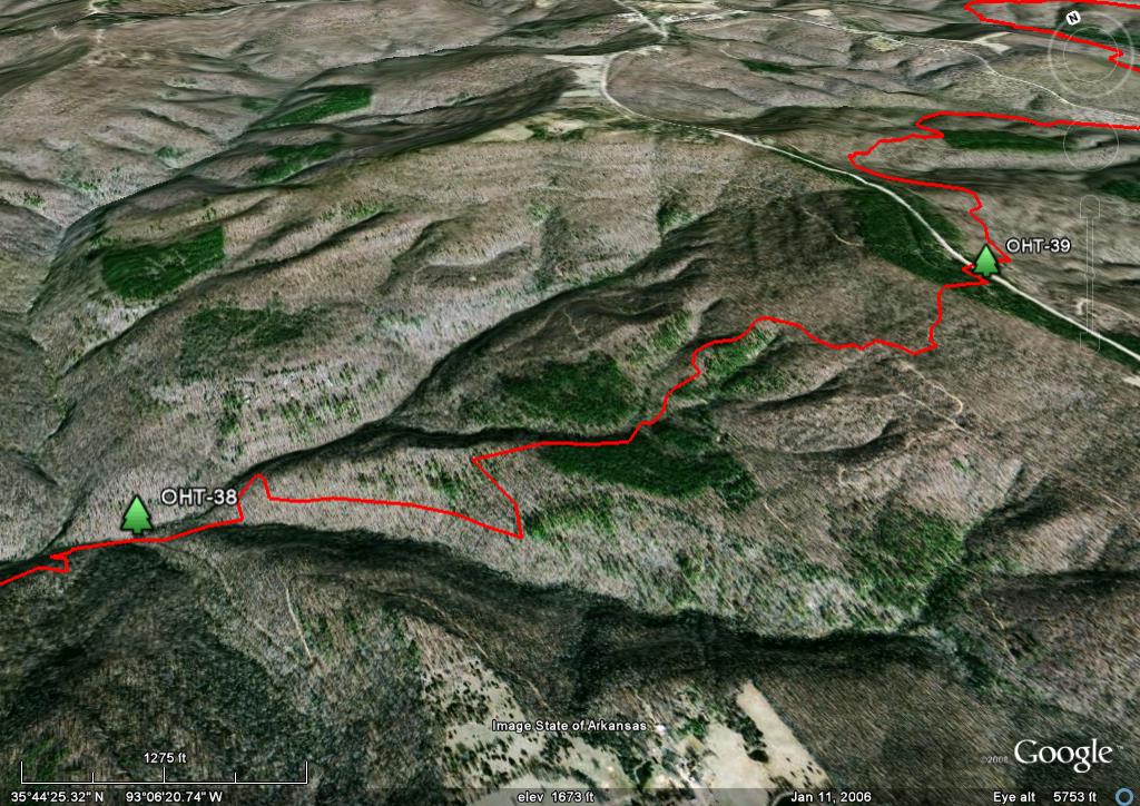
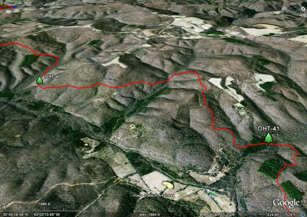
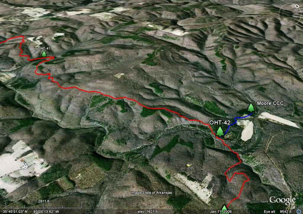
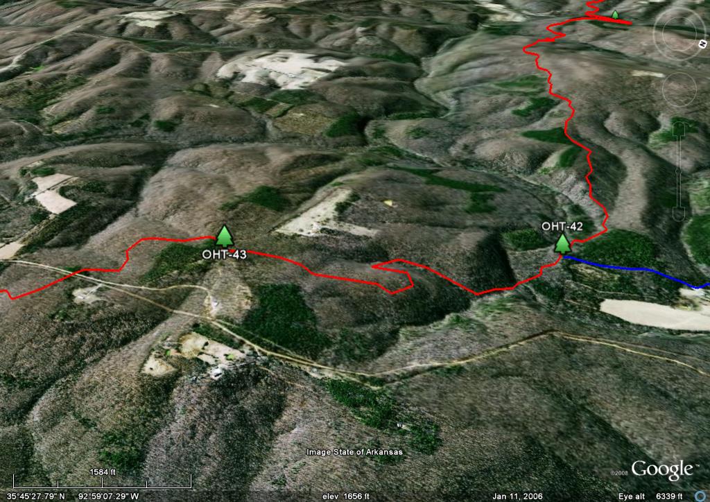
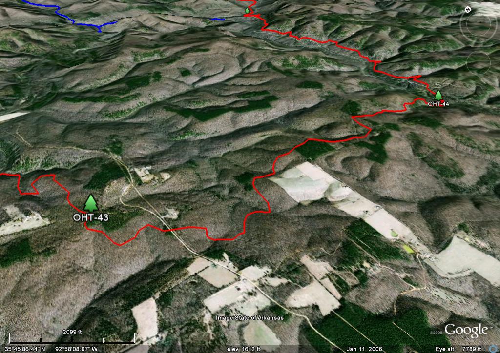
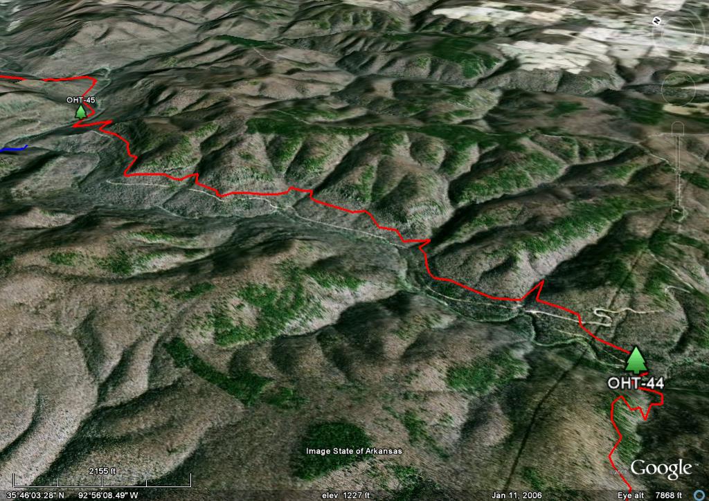
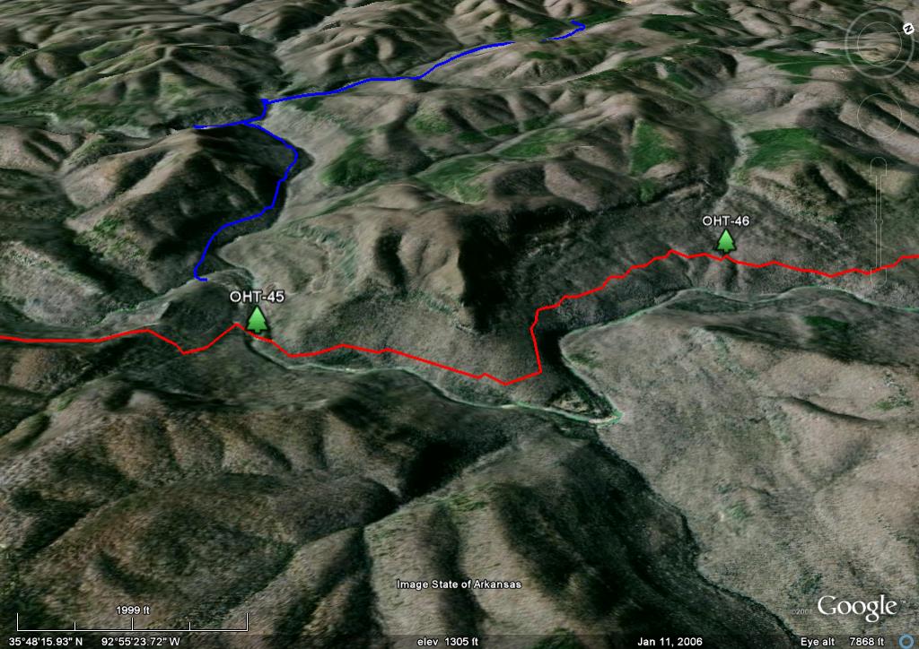
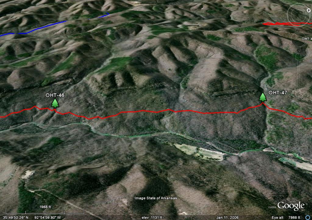
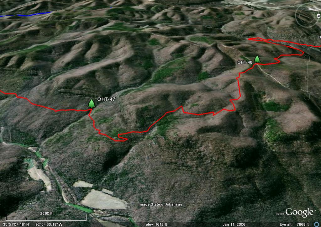
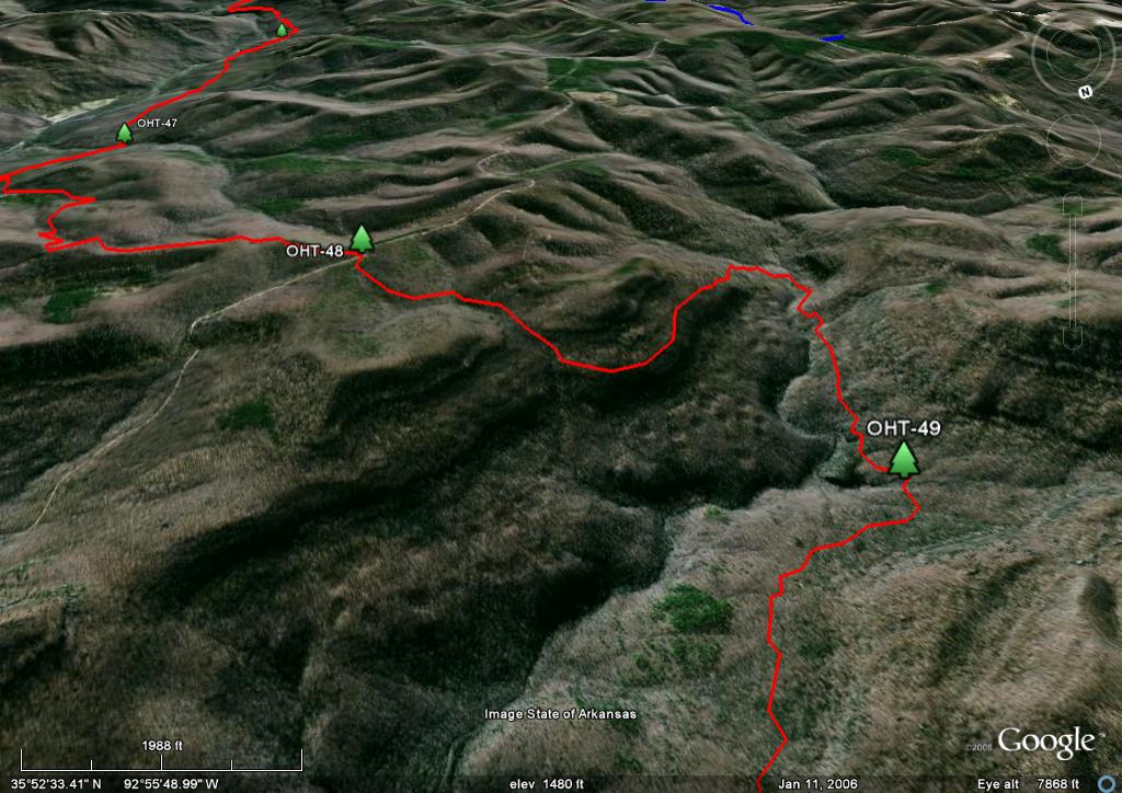
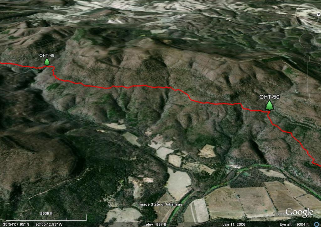
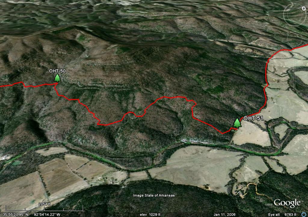
The base maps are a composite of USGS topos. The OHT is shown in red and other trails are shown in blue. Mileages between waypoints are provided and are based on the offical distances between mile markers. The forest roads have been enhanced and updated using aerial photos, satellite imagery and the 2005 Ozark National Forest map. Many different road designations are shown because they have different names on different maps: Some are forest roads, some county roads and some are local names.
The maps have been updated since I first posted them in January 2008. I have re-GPSed the trail from Lake Fort Smith to Woolum and added the trail description pages. I was foiled by highwater so the 1.4 mile section between Ben Hur and the Richland Creek crossing is based Eric Strong’s 2004 GPS track and Google Earth. Because of the scale of these maps and GPS data, they are the most accurate maps available for the trail. I hope you find these useful for your next trip to the Ozarks.
GPS File: Right click this link and Save Link As to download the GPS tracks in a gpx format. Save it to your computer and use your GPS software to load it to your GPS. There are over 1,000 track points so if it exceeds your saved track capacity, you will need to break up into more digestible bites.
Google Earth Track: Unfortunately Google depreciated the GE API so you can't look at the OHT on GE from this website anymore. Instead. right click this link and Save Link As to download the track in the Google Earth kml format. Open the kml file in Google Earth and trace the route in interactive 3D.
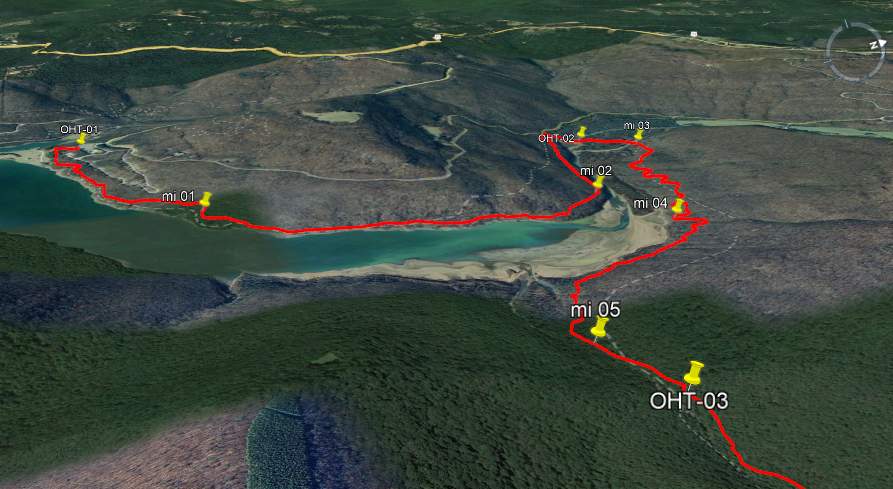
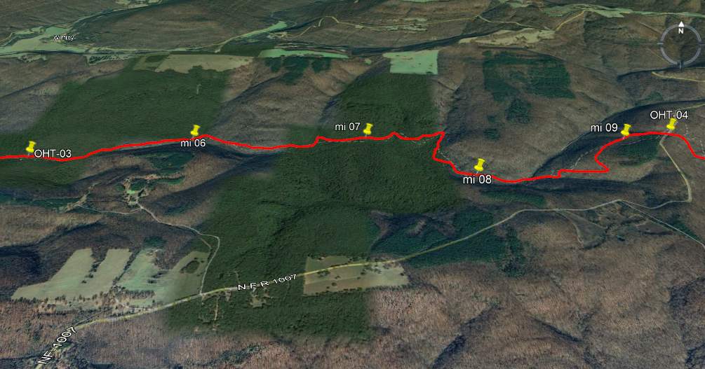
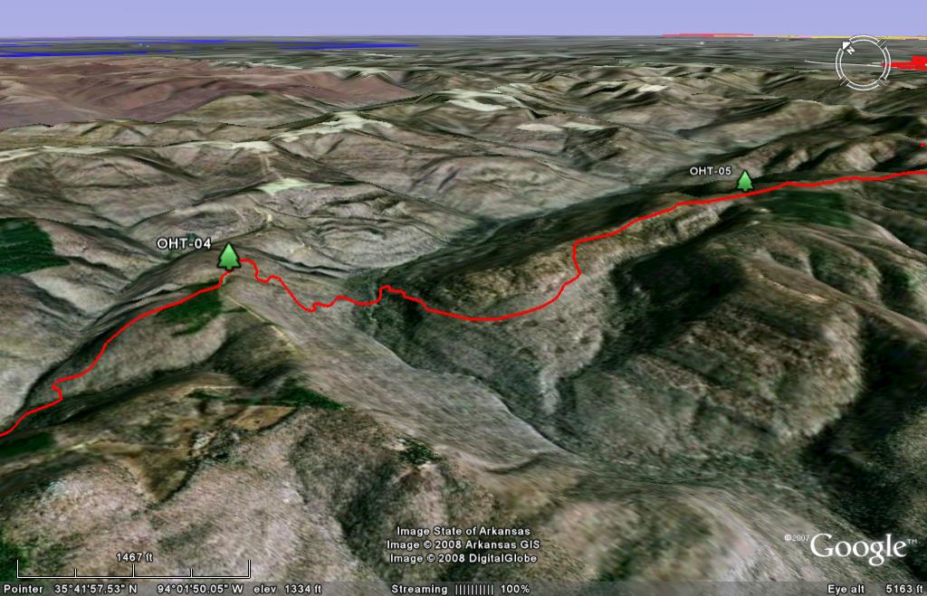
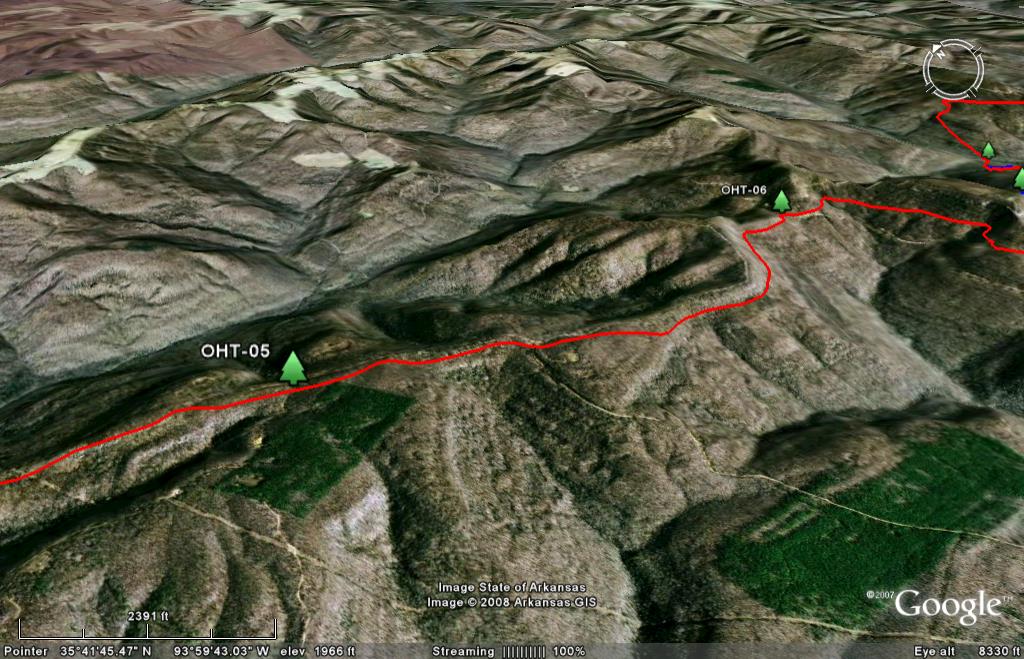
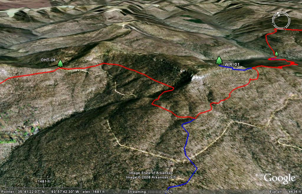
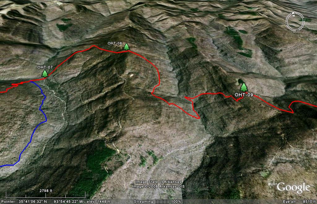
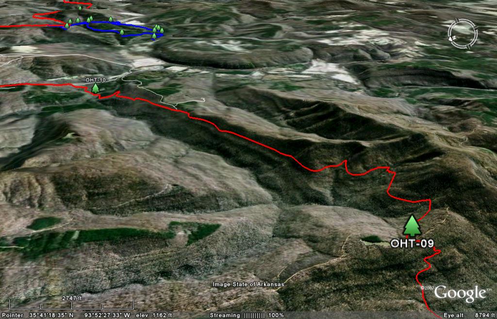
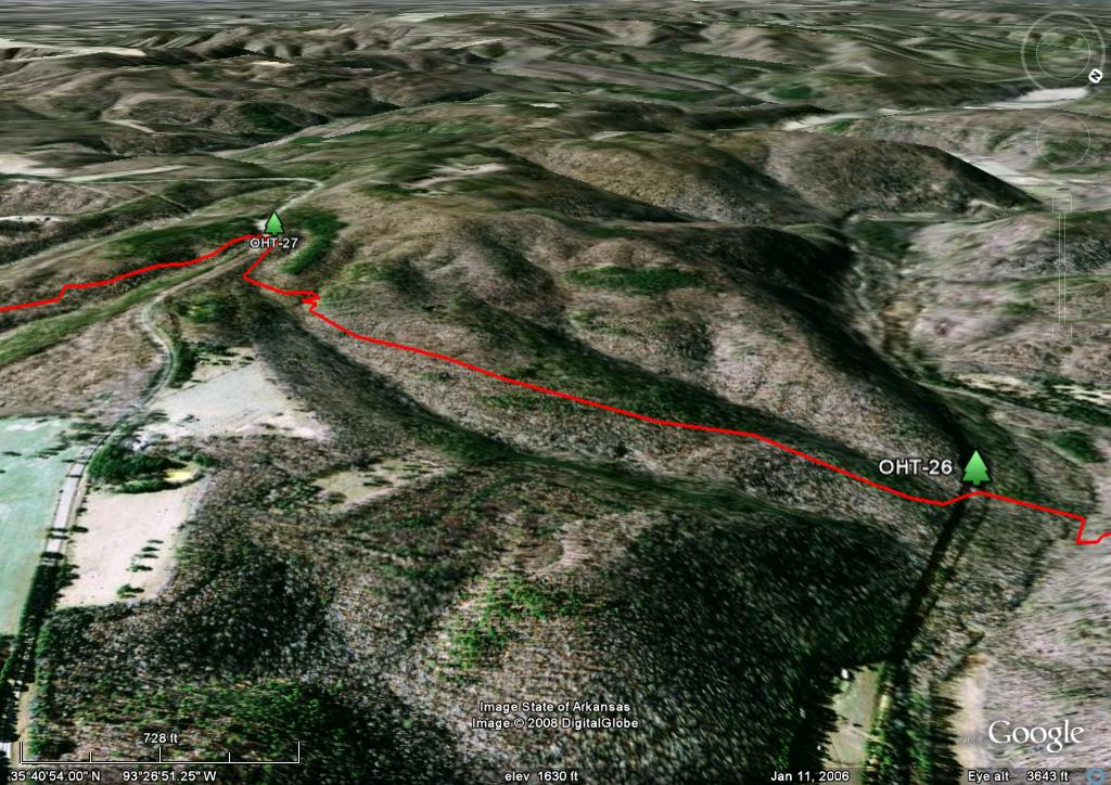
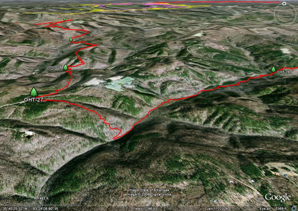
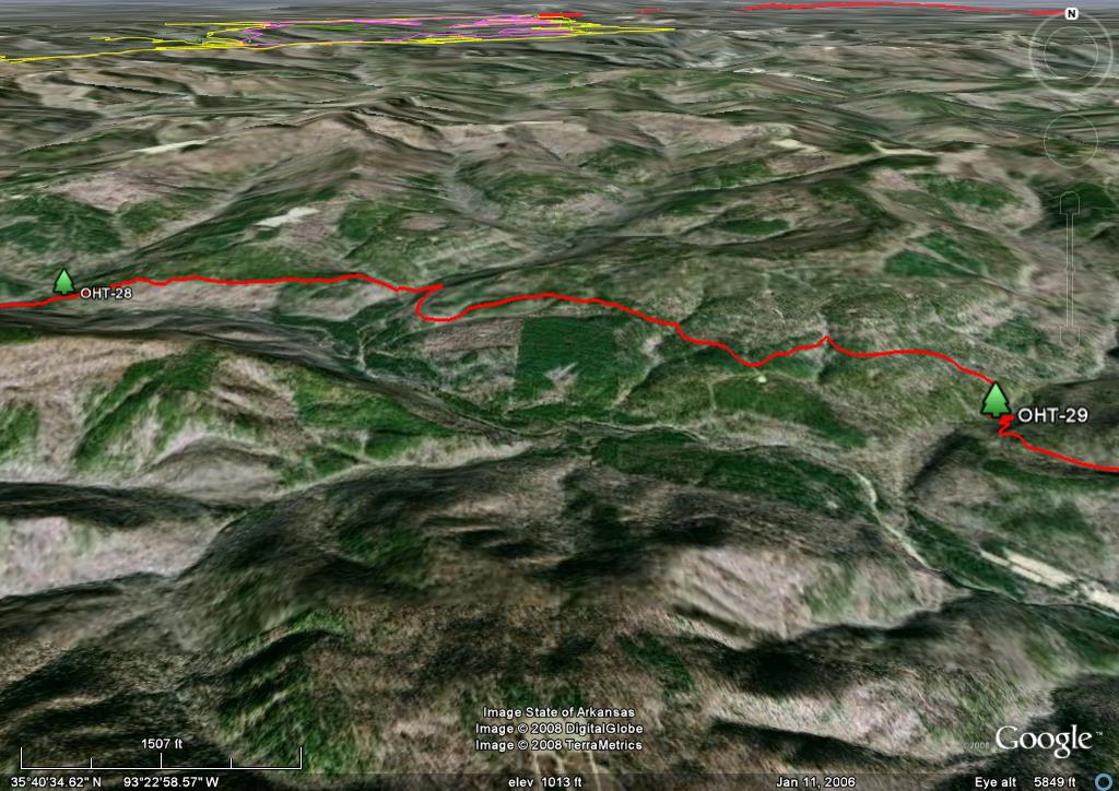
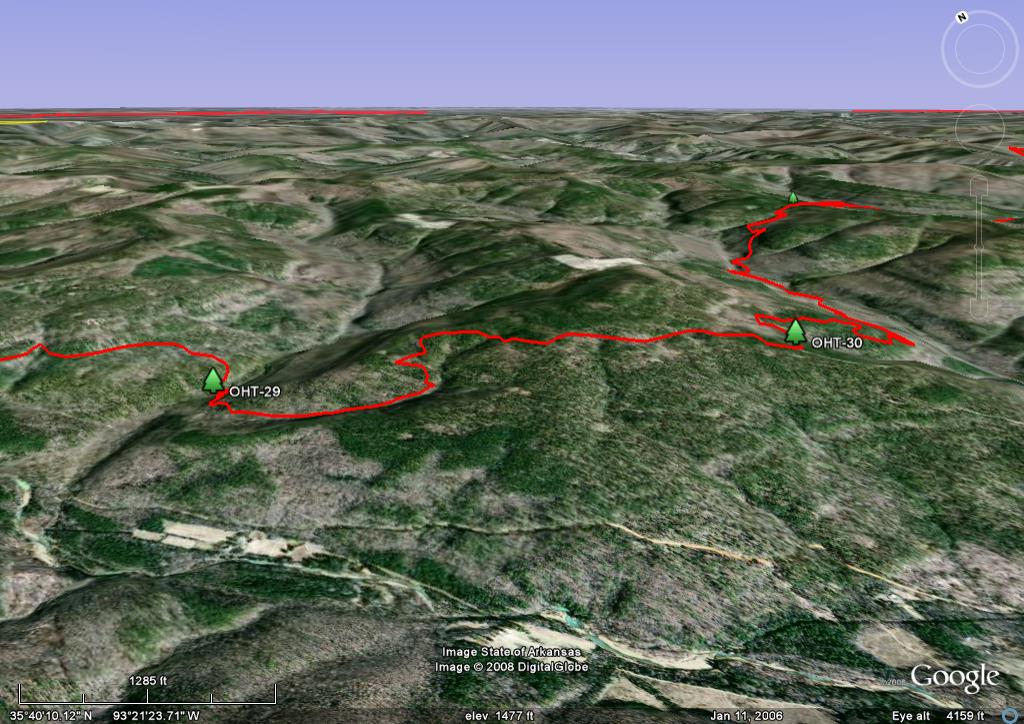
Google Earth Images. Google Earth still images of the entire trail are provided below with each map. Here is an overview map of the entire trail. You will note that the orientation changes on each one so that north may be up, down or any which way. The reason for this is because I have tried to orient each scene to provide the best view of the trail and to highlight the topography.
Trail Mileage. A mileage table is provided as an Excel spreadsheet file. There is an West to East version and an East to West version so it is ready to use regardless of your route. Since it is a "live" file you can sum your mileage to get a better idea of the length of your days. Check out column "D." By copying the formula in one of the cells to the beginning and ending location of a day and deleting the formulas in between, you can get subtotals. Feed back welcome! Also, if you prefer mileage tables in a PDF format, here they are. Here is the West-to-East version and here is the East-to-West version.
Waypoints. A table of the 52 waypoints in Lat-Lon, decimal degrees (pdf format) is provided.
The Ice Storm: An ice storm during the week of January 26, 2009, forced the OHT to be closed for a while. The Ozark Highlands Trail Association (OHTA) did a great job of clearing dead trees and recently laid a new trail in the Richland Creek area. Thank you! Here are some Forest Service pictures to give you an idea of the severity of the ice storm (Credit: Ozark National Forest).
