Comanche-Venable Loop, Sangre de Cristo Wilderness, Colorado.
Free downloadable topo maps of the Comanche-Venable Loop
Printed maps are also available for purchase.
The Sangre De Cristo Range is a northwest-southeast trending mountain spine in south central Colorado that features a series of northeast-southwest trending glacially carved valleys. While there are trails going up many of the valleys, these maps focus on one of the few "official" loops. There are two versions of the loop. The more popular east loop starts on the east side of the range at Alvarado Recreation Area near Westcliffe and uses the Comanche and Venable valleys to enter and exit the high country. Connecting the two and traversing the connecting ridge, is Phantom Terrace. Phantom Terrace is also the connector for the west version of the loop. It begins at North Crestone Campground and makes a lollipop loop using the Middle and North Forks of Crestone Creek.
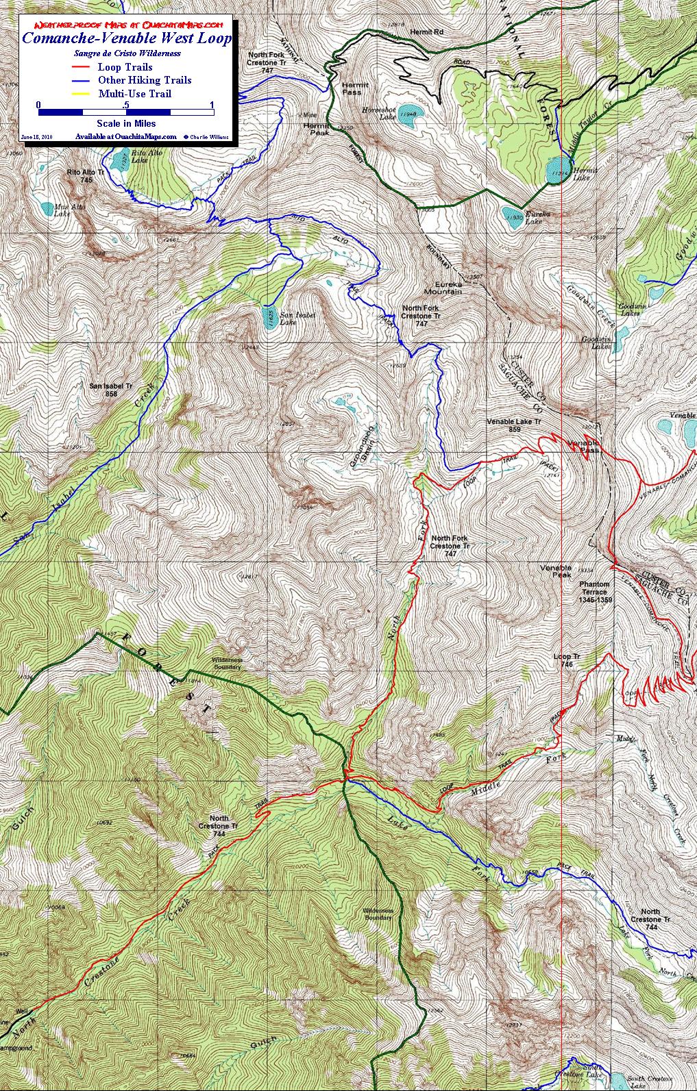
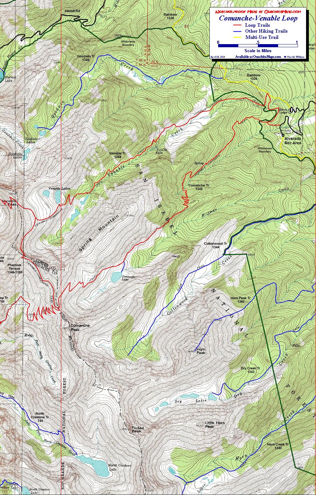
The Maps: There are 3 maps: one area map and two trail maps. They are available on this page as a downloadable jpg. The two trail maps are also available printed in color on 11x17, "Rite in the Rain” all weather writing paper for $5 plus S&H by emailing Charlie at cew5151@gmail.com. The maps are nominal 1:24,000 based on USGS 7.5 minute quadrangle topographic maps. The loops are shown in red. The yellow trail is the multi-use Rainbow Trail, which is necessary for many of the trails on the east side of the range. All other trails are blue. The green line is the wilderness boundary. The forest roads are in gray and based on aerial and satellite imagery.
GPS File: Right click this link and Save Link As to download the tracks in a gpx format. Save it to your computer and use your GPS software to load it to your GPS.
Google Earth Track: Right click this link and Save Link As to download the track in the Google Earth kml format. Save it to your computer, and open it in Google Earth and trace the route in interactive 3D.
Background: Sangre De Cristo means Blood of Christ in Spanish. The Sangre De Cristo Mountains are a 250 mile long range in south central Colorado and north central New Mexico, beginning south of Poncha Springs, CO and ending south of Pecos, NM. The mountains are divided into several sub-ranges and this hike will focus on the northern Sangre de Cristo range.
The range starts at Poncha Springs and ends at the Blanca Peak massif north of Fort Garland, about 82 miles. If you take Hwy 285 from Poncha Springs to Alamosa, it is the mountain wall to you east. The range is very narrow, generally less than 9 miles. On the west side it climbs out of the San Luis Basin at an elevation of about 8,000 feet, to over 14,000 feet. It is the home of 10 14ers, including Crestone Peak, Crestone Needle and Blanca Peak.
On the east side of the range is Wet Mountain Valley, the home of Westcliffe CO. Westcliffe is a 7800 feet. Alvarado Recreation Area, the trailhead for the Comanche and Venable trails, is at 8,800 feet and a 10 mile drive from Westcliffe.
The narrowness and height of the range defines the many hiking trails. Most are in and out hikes coming in at the lower valley and ending at 11,500+ feet at tarn. The headwalls in the cirques are around 13,000 feet elevation and are extremely steep and technical. Inspite of glacial terminology, there are no glaciers in the range.
The loop hikes presented here are the exceptions. While the elevations and terrain are similar, there are tails over the east-west divide.
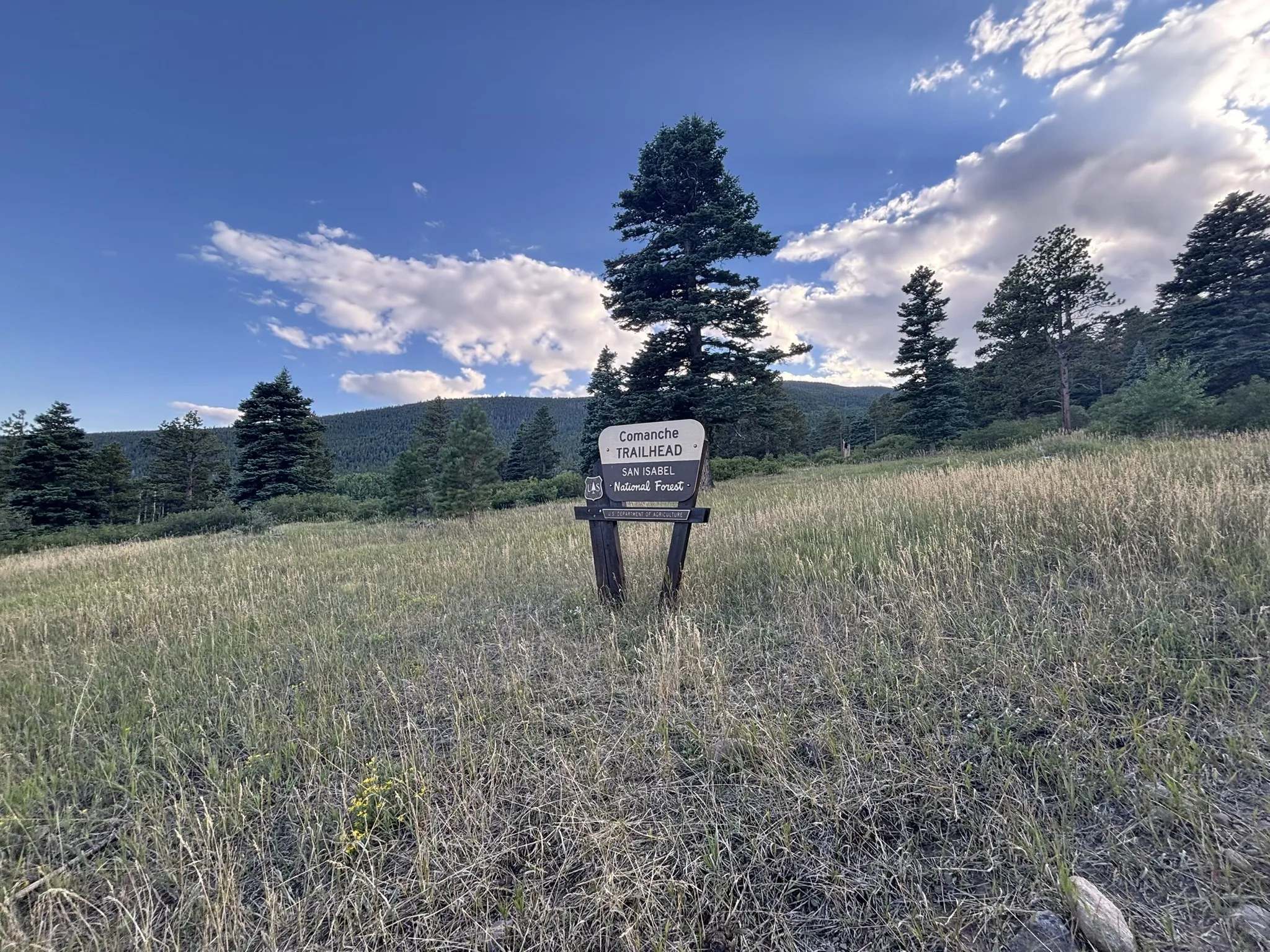
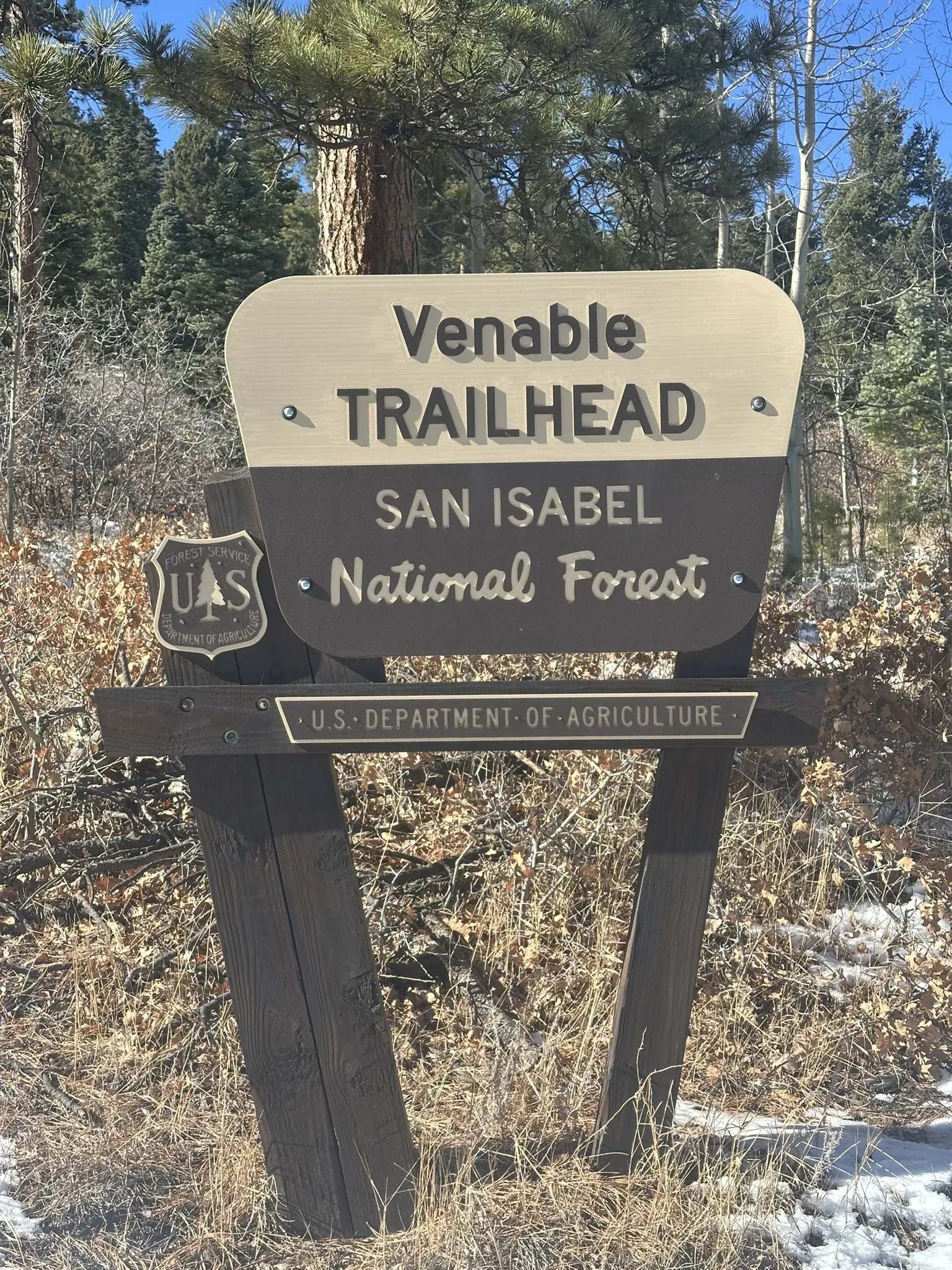
The East Hike: The east hike begins at Alvarado Recreation area. There is a campground there for your convenience. This narrative will go counter-clockwise starting at the Venable Trailhead (Photo credit: Mark Hellige)..
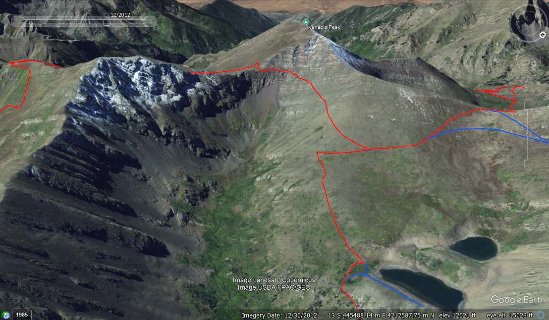
The loop is 12 miles. The Venable Trail is 4.9 miles up to the junction of the Phantom Terrace Trail near the the crest of the divide. The trailhead is at 9,000 feet and the Phantom junction is at 12,400.
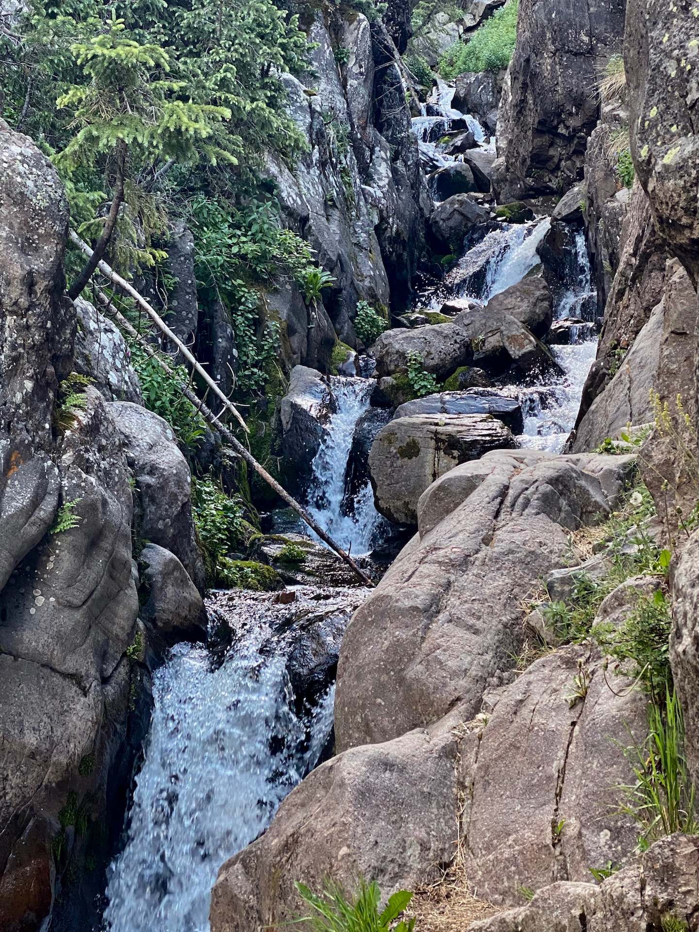
The trail begin with a 300 foot climb over 0.4 miles to the junction of the Rainbow Trail. But first it crosses Venable Creek on a wooden bridge at 0.1 miles. The Rainbow Trail is a 100 mile multi-purpose trail that follows the base of the Sangres range at between about 9,000 and 9,500 feet. As a multi-use trail, it also follows the wilderness boundary in many places. Although there are ample Aspens across the valley to the south, the Venable Trail does not go through them until about 1.4 miles. The aspen dominate until the Venable Falls sign at mile 2.3 (elev 10,400). The falls (Photo credit: BIT|Hiker) is a long cascade best seen from the spur trail.
The trail maintains a steady climb and at mile 3.7 (elev 11,400 feet) reaches the "lower lakes". There are probably half a dozen little ponds in the valley connected by the creeks and marches. They are best seen on the way up to the two main lakes.
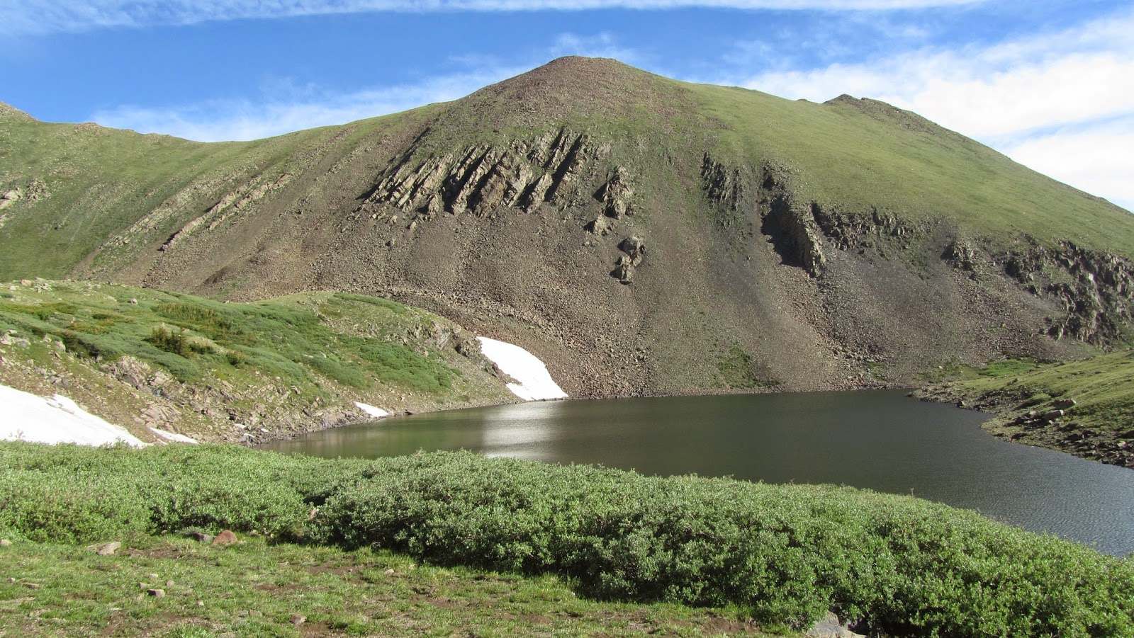
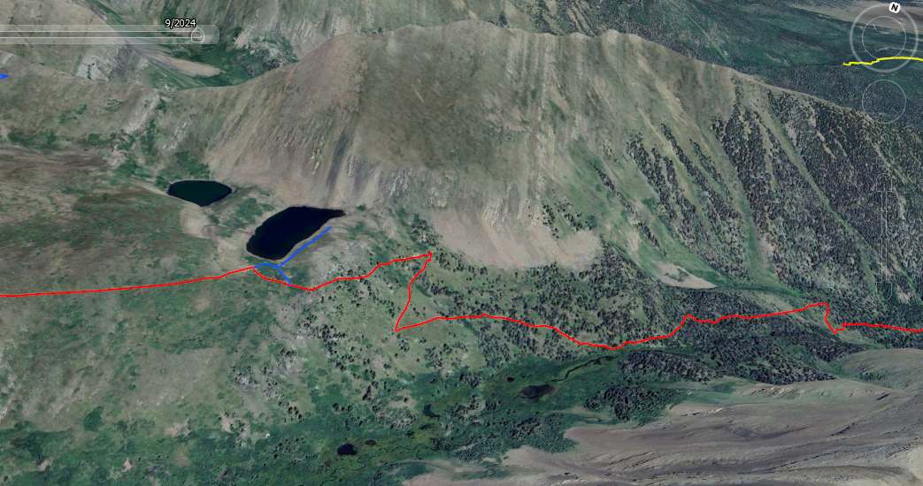
The two main Venable Lakes are on a bench on the north side of the valley and require two large switchbacks to reach them. The spur trail to the two lakes is at 4.4 miles and 12,050 feet. The lower one is the largest. Both lakes are above the tree line so any camping will be in the open. Alternatively, you can look for a site when you get to the "lower lakes" in the valley.
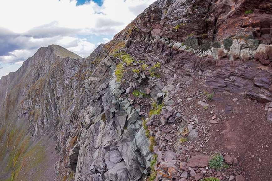
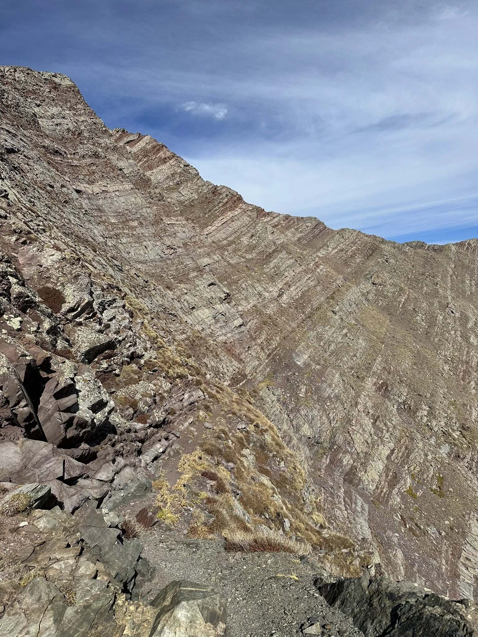
It is 0.4 miles up to the junction with the Phantom Terrace trail (elev 12,200). Phantom Terrace is the crux of the loop. Not only is it the highest point on the loop, it features a half mile section across the steep and exposed (Photo credit: Connor O'Brien.) east face of Venable Peak on an extremely narrow trail. The rock face is 300 million year-old Minturn Formation. It is composed of fossiliferous limestone, shale and conglomerate deposited during the the Ancestral Rocky orogeny. The narrow part of the trail follows the bedding planes.
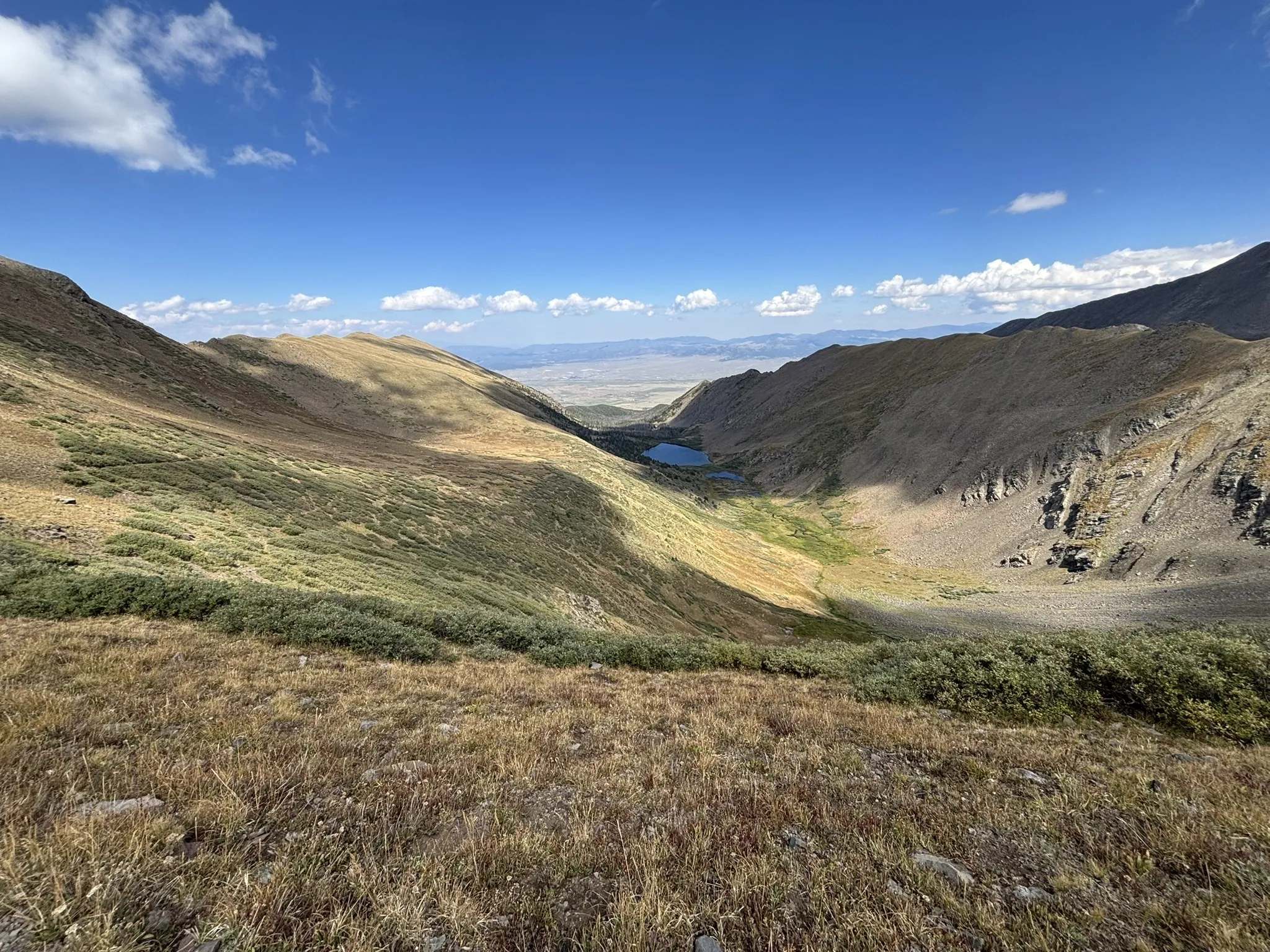
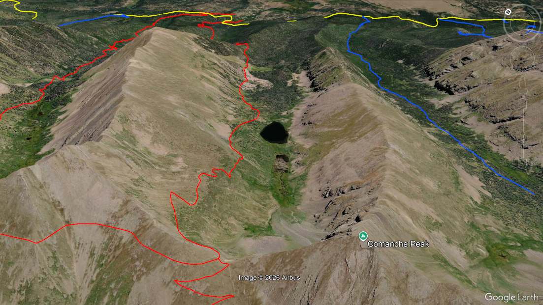
The trail clears the exposed face and crosses the saddle between Venable Peak and the unnamed 13,244 foot peak to the east (saddle elev 12,760). It stays on the moderately steep grassy slope below peak 13,244 for 0.9 miles until it reaches the west saddle of Comanche Peak (saddle elev 12,760). The Comanche Lake valley stretches out before you.
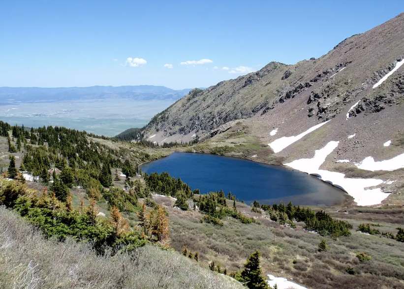
It is 1.4 miles and a descent of 1,000 feet to the Comanche Lake spur. Still well above the timberline, the trail is on a grassy ridge affording a view of the lake the whole way down. There are two lakes. The upper is small and can be more of a marsh if it has been real dry. The lower one is larger and a real beauty. If you are planning the camp there, there is a social trail on the north side of the Comanche Trail across from the spur. Follow it to the top of the knoll.
The spur is 7.7 miles into the hike, at 11,700 feet. The Comanche Trail continues on the side of the ridge for another 1.2 miles when it crosses the nose of the ridge. (Fun fact: the creek that drains Comanche Lake is Hillman Creek.) Below the nose are a a half dozen switch backs that ultimatly take you across a small creek. (Fun Fact 2: This is the headwaters of Alvarado Creek that flows through the Alvarado Campground. As far as I know there is no Comanche Creek near here.) Once across the creek, it is about 1.7 miles to the Rainbow Trail and Wilderness boundry and another 0.3 miles to the trailhead (elev 9,150). The total loop is 12 miles.
The West Hike: Admittedly, the west loop is not a usual hike for a loop. As noted, most prefer to come in from Alvarado. However, we happened to be in Crestone (the city not the peak) and with a 2 hour drive to Westcliffe we chose to start from there.
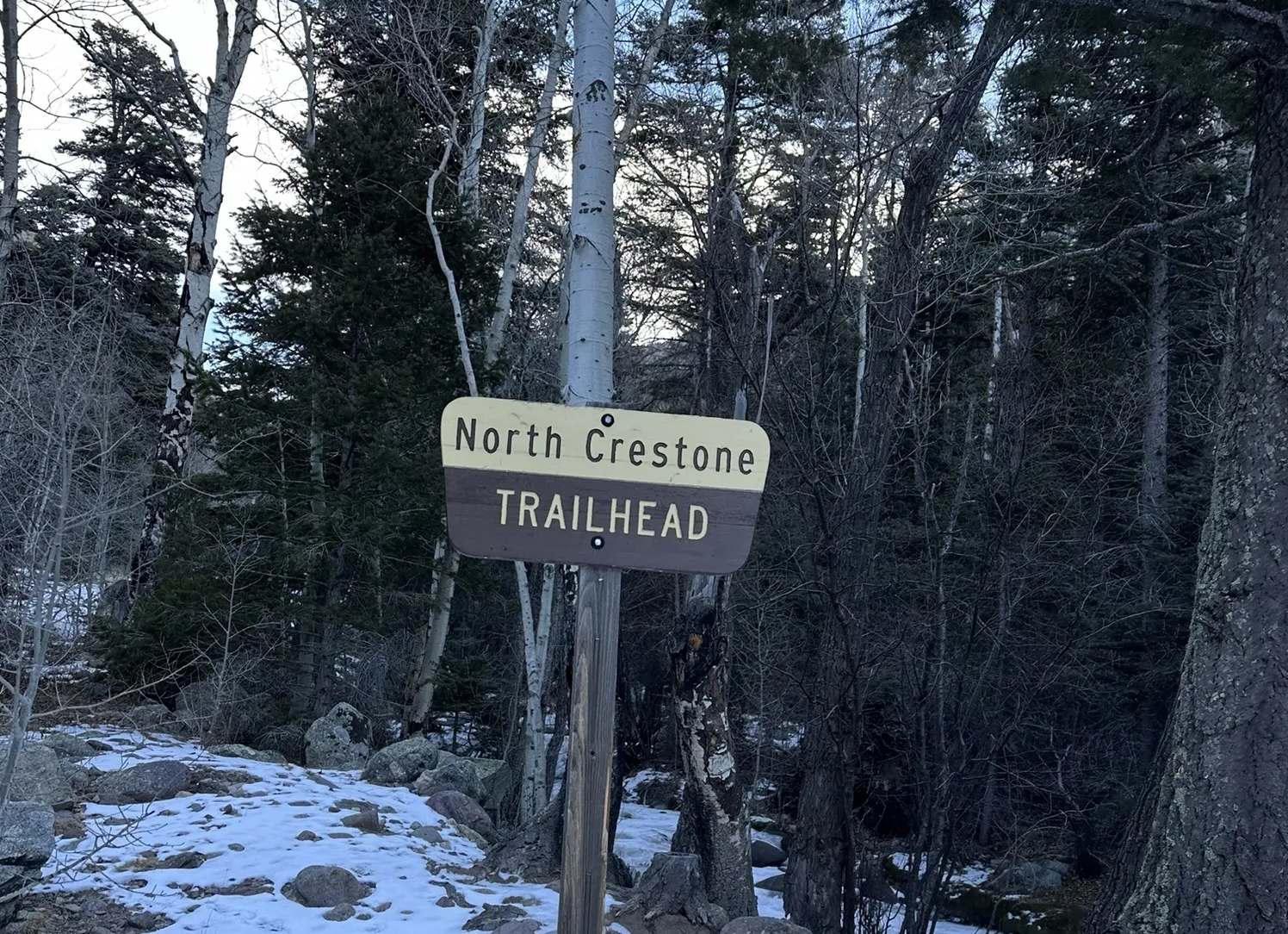
To get to the North Crestone Trail, #744 trailhead go north out of Crestone on County 71, Spillway Road. It will turn to the north east and enter the narrow canyon of North Crestone Creek. Go 0.7 miles to the trailhead parking lot, passing the North Crestone Creek Campground sites along the way. The road ends at the trailhead parking lot (elev 8,600 feet).
The trail stays low in the canyon on the northwest side of the creek for 2.5 miles. After crossing North Crestone Creek coming from the north there is a junction. Heading north is the North Fork Crestone Trail, #747. Going straight or east is the Loop Trail, #746. The North Crestone Trail turns right (south) up the Lake Fork Trail. This is the more typical route to North Crestone Lake (elev 11,800). The entire trip to the lake from the trailhead is 5.7 miles with an elevation gain of 3,200 feet. This type of trip from a trailhead to a lake in a closed valley is very typical of the Sangre De Cristo range.
As for the loop, we are going east on the Loop Trail. The creek crossing is at 9,850 and it is a 2,900 foot climb over 4.4 miles to the saddle between Peak 13,244 and Comanche Peak. If you are keeping track, that's 6.9 miles and a gain of 4,150 from the trailhead. We dropped down to Comanche Lake to camp, adding another 1.4 miles.
The next day we climbed back to the saddle and went off trail to climb Comanche Peak. After coming back down to the junction, we went north on the Phantom Terrace Trail. Coming over the Peak 13,244-Venable saddle was quite the surprise. This was pre-internet and we had no pictures, videos or trail notesto give us an idea of what it looked like. In spite of our trepidation, we crossed the east face of Venable Peak.
The Phantom Terrace Trail intersects the Venable Lake Trail at an elevation of 12,400 feet, above Venable Lakes; keep going north and up to Venable Pass (elev 12,800). Next it is down a 1,000 feet and 1.4 miles into a small cirque to the junction of the North Fork Crestone Trail, #747.
Although it is only 2.6 miles to the North Crestone Trail #744, we took a side trip and camped at the mouth of Groundhog Basin. We explored it and climbed the rim to see San Isabel Lake on the other side.
The next day was 2.6 miles to the North Crestone Trail and then another 2.5 to the trailhead.
To Buy Maps: The entire trail is on one map. Color, 11x17 maps on weatherproof paper are available for $5 each plus S&H by emailing Charlie at cew5151@gmail.com (copy and paste in your email).