
Crested Butte to Aspen hike, Elk Mts, Colorado
Free downloadable topos of the Crested Butte to Aspen hike
Printed maps are also available for purchase.
When the discussion about the best day hikes in Colorado comes around, the Crested Butte-Aspen (or vice versa) is always at or near the top. The 11 mile hike through the Elk Mountains connects the two towns by crossing West Maroon pass. A aerobic alternative to the 4:20 drive around the mountain range.
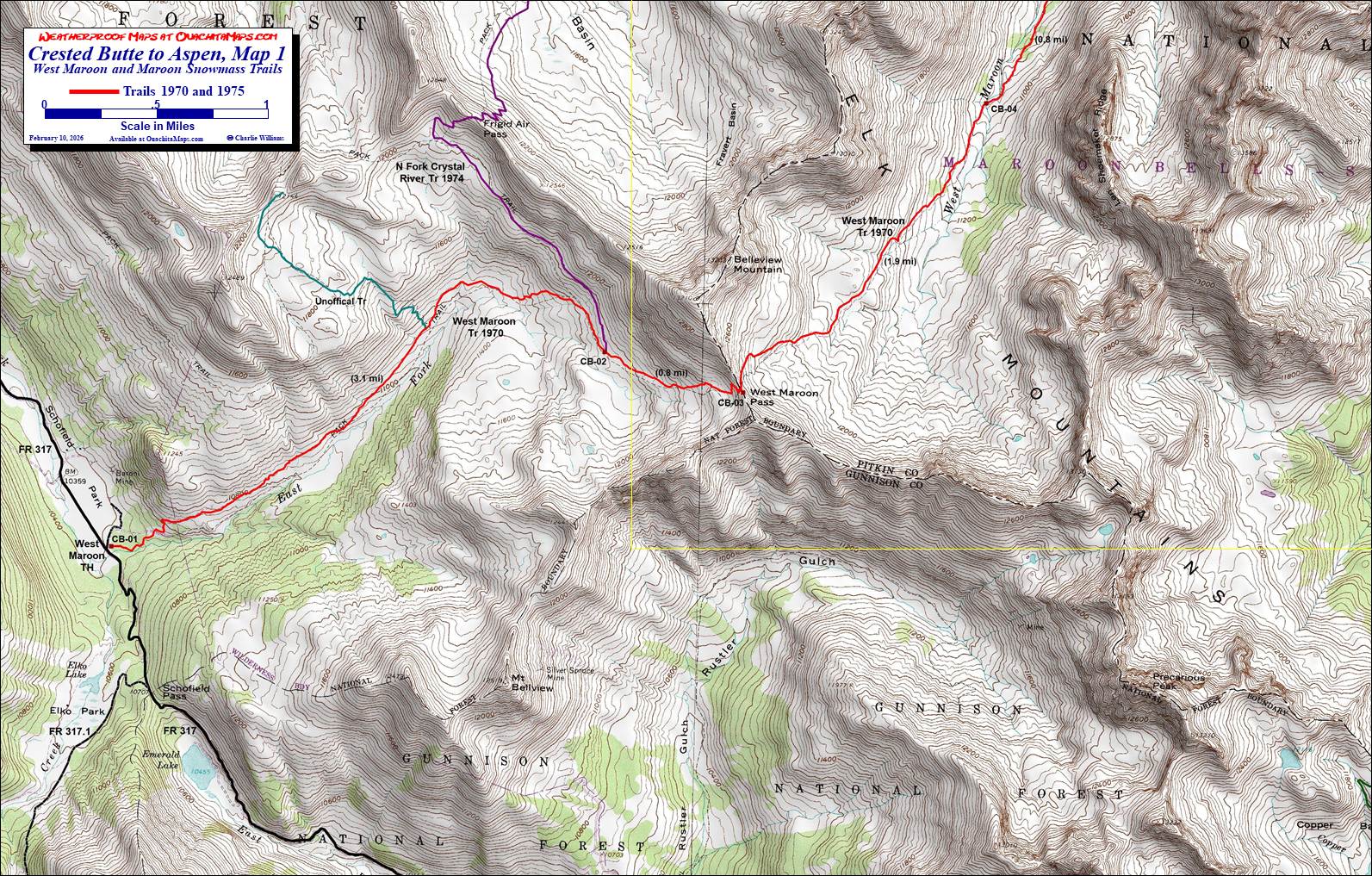
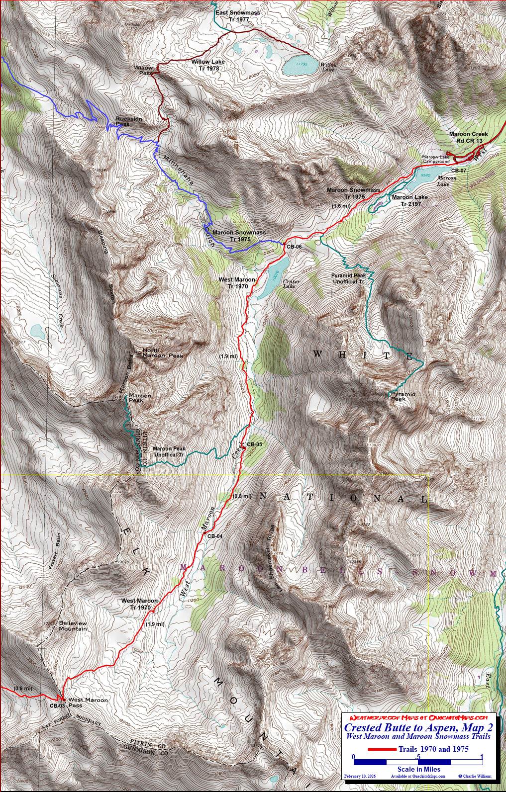
The Maps: There are two FREE maps on this page. Each are true 1:24,000 scale based on the USGS 7.5 minute quadrangles. Since we hiked from Crested Butte to Aspen, Map 1 is the first section from the trailhead at Schofiled Park, over West Maroon Pass and partway down West Maroon Creek. Map 2 starts at West Maroon Pass and follows West Maroon Creek past Maroon Lake. The free maps are pre formatted to print on 11x17 paper. Alternatively, the two maps are available on 11x17 Rite in the Rain weatherproof stock for $5/sheet ($10 for the set) plus S&H. Email cew5151@gmail.com.
GPS File: Right click this link and Save Link As to download the tracks in a gpx format. Save it to your computer and use your GPS software to load it to your GPS.
Google Earth Track: Right click this link and Save Link As to download the track in the Google Earth kml format. Save it to your computer, and open it in Google Earth and trace the route in interactive 3D.
Background: Some clarifications are needed. First, this 11 miles is not from town to town. The trail actually starts at the West Maroon Trailhead at Schofield Park, over an hour by car from Crested Butte. Schofield Park is a mountain park, a large grassy area, not a city park, but there is a vault toilet at the trailhead. On the Aspen side, the trail stops at Maroon Lake, the iconic lake in the foreground of all the Maroon Bells pictures. It is over a half hour from Aspen. Second, there are shuttles that can help with this hike but if you just doing a point to point, you are still looking at over 4 hours to get you back to your car, plus the drive back to town. Considering the time you will need on the trail, you may be looking at two nights out, either in a hotel or a tent. Third, the road from Crested Butte can be rough. There is a section before Emerald Lake that is single lane with a drop to the creek on one side and a small bluff on the other. Just before that going north was a spot that challenged our all wheel drive SUV. I am not sure a 2 wheel drive car could have made it. Fourth, the Maroon Bells scenic area has car restriction. Though it is possible to drive up there, there are some hoops to jump through. They want you to take the shuttle from the lake to the Aspen Highlands Ski Resort. Fifth, there is an alternative 16.5 mile hike from Gothic (north of CB) on the Copper Creek that crosses East Maroon Pass.
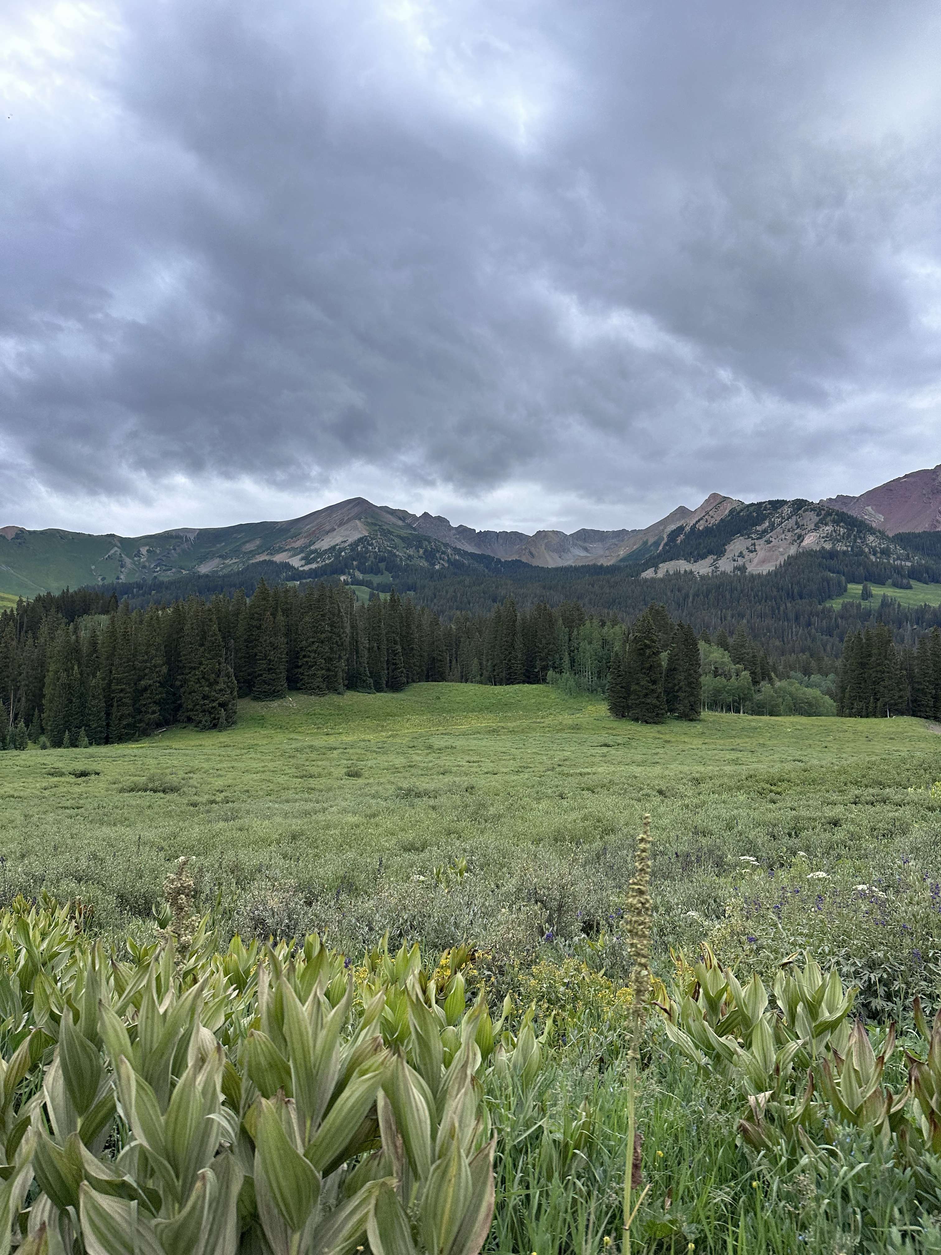
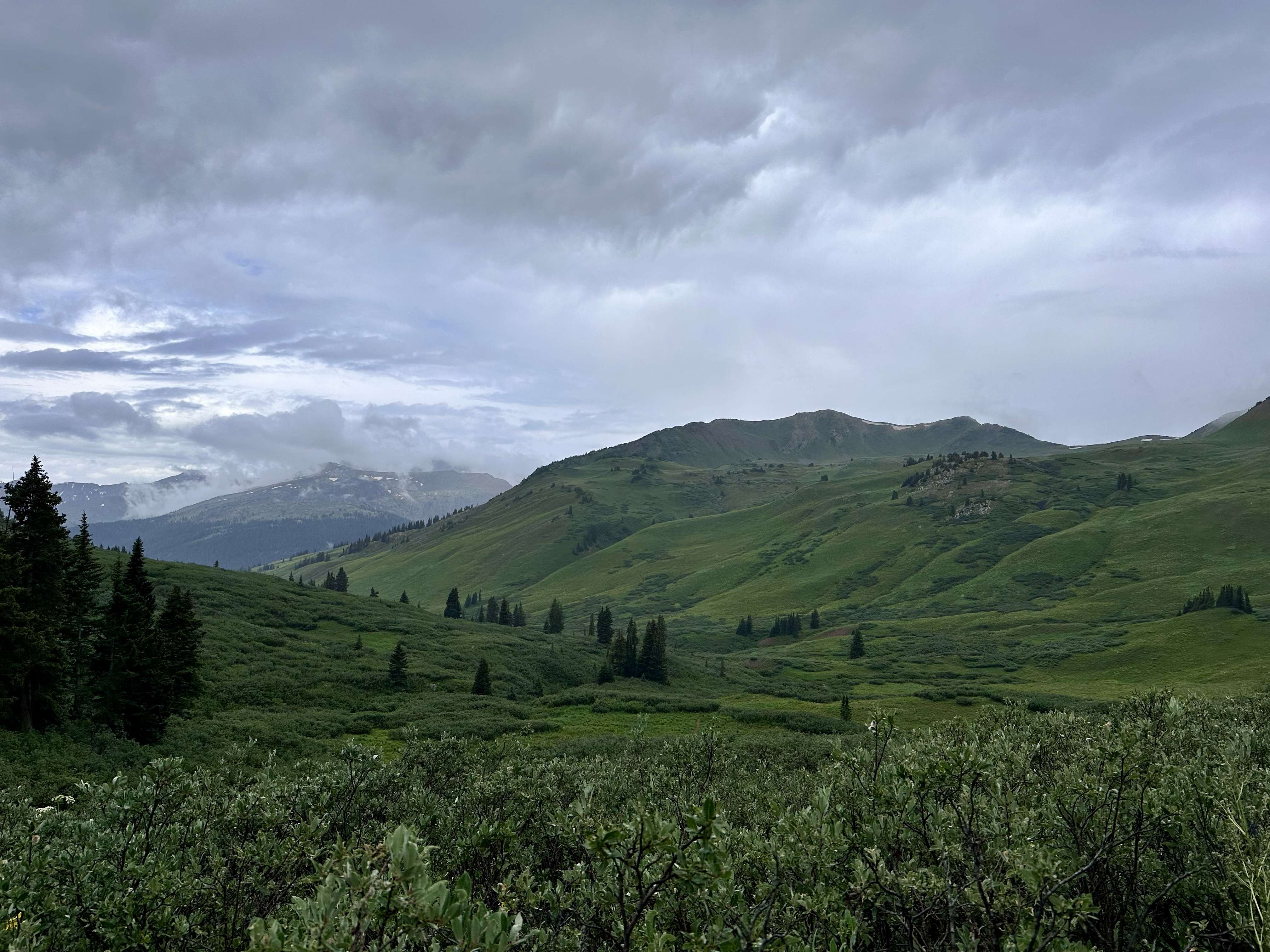
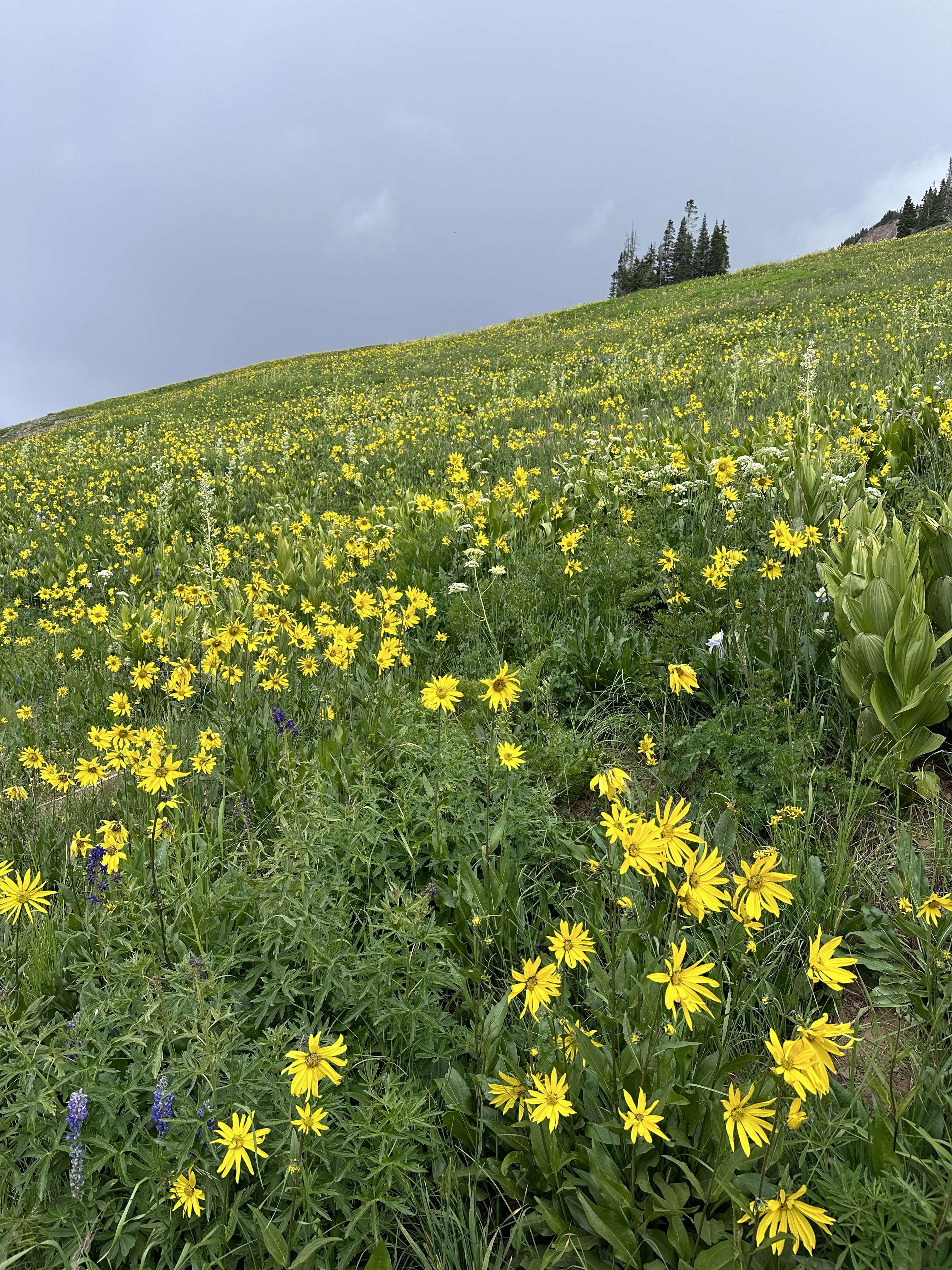
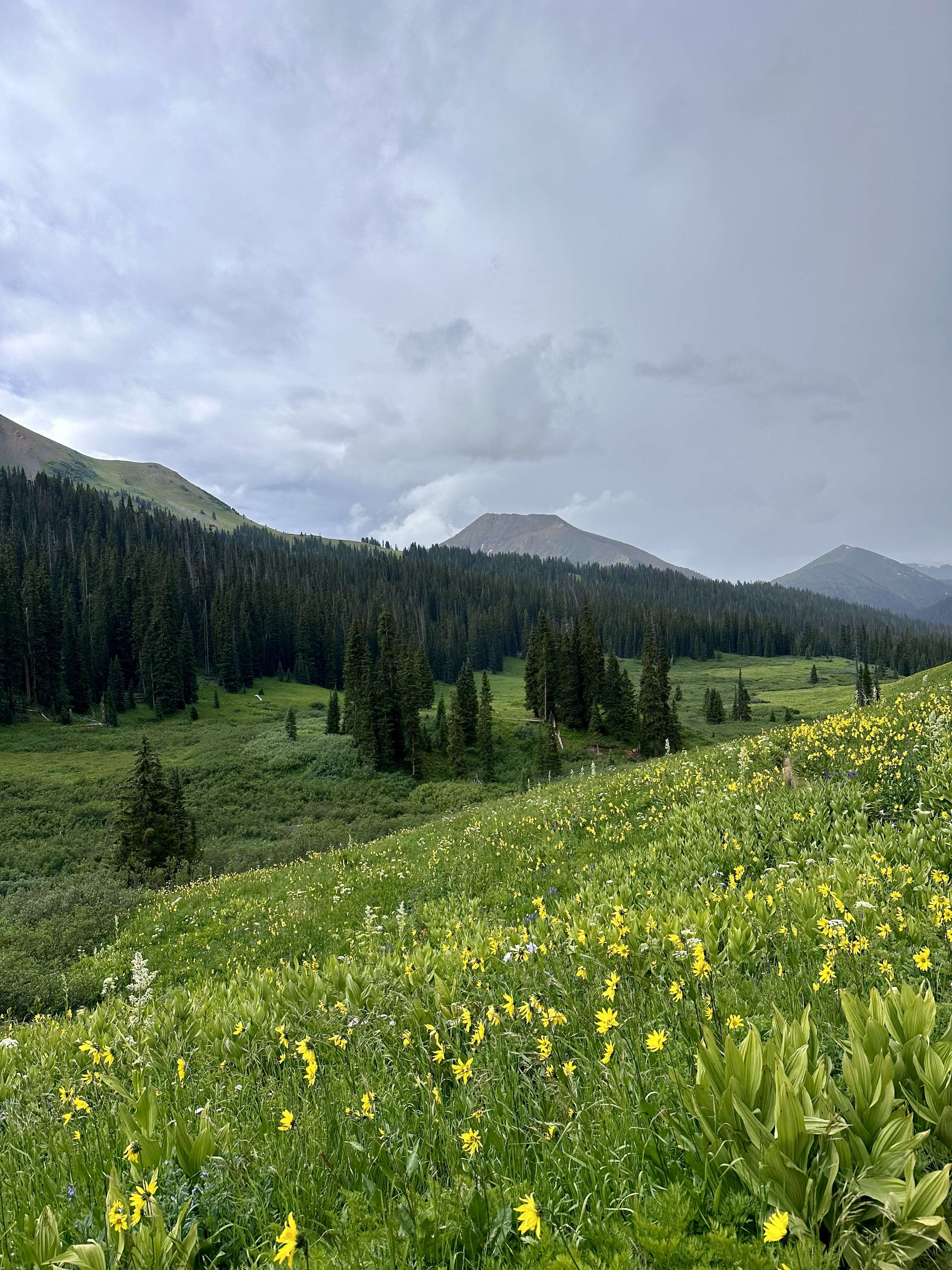
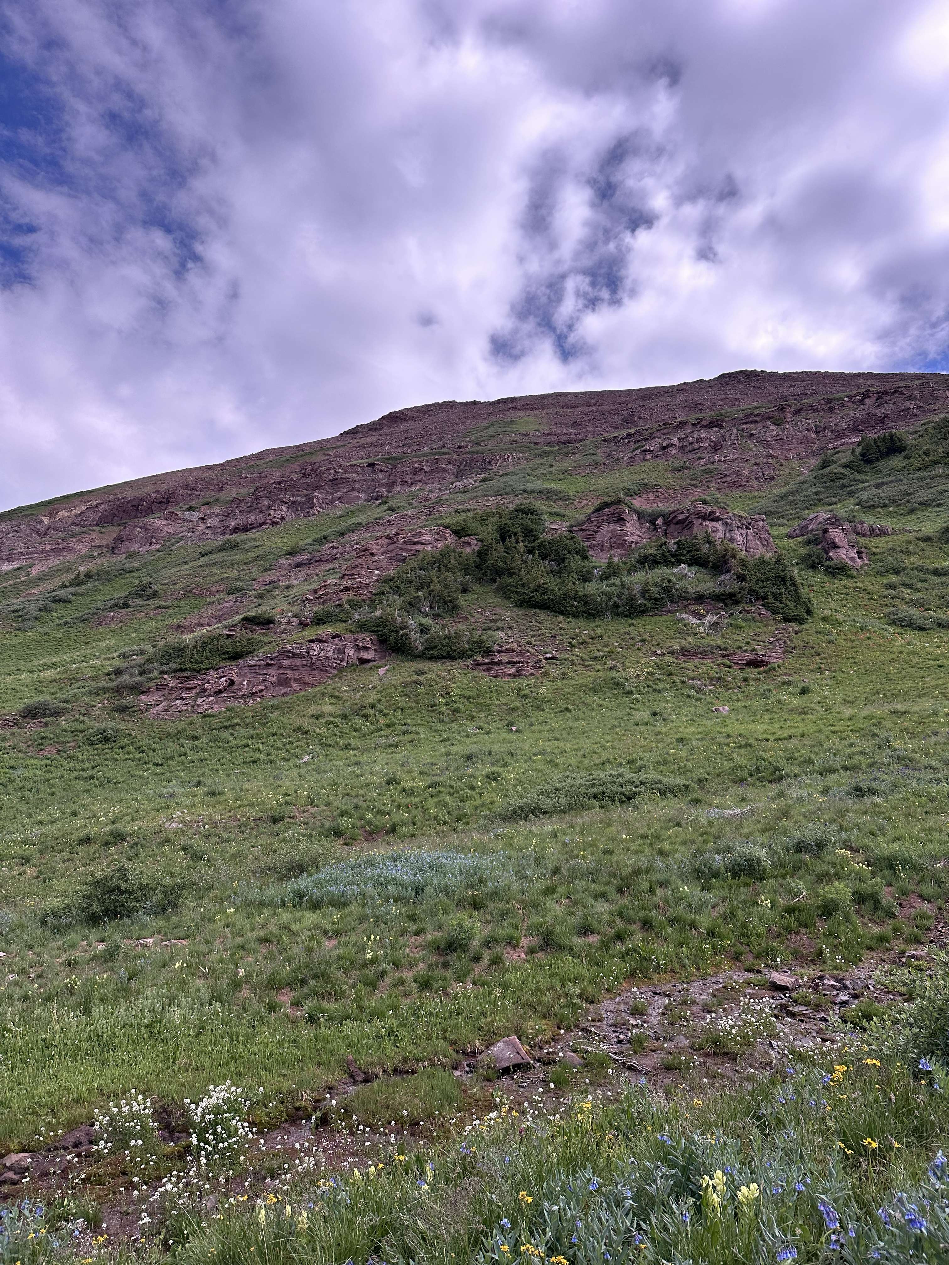
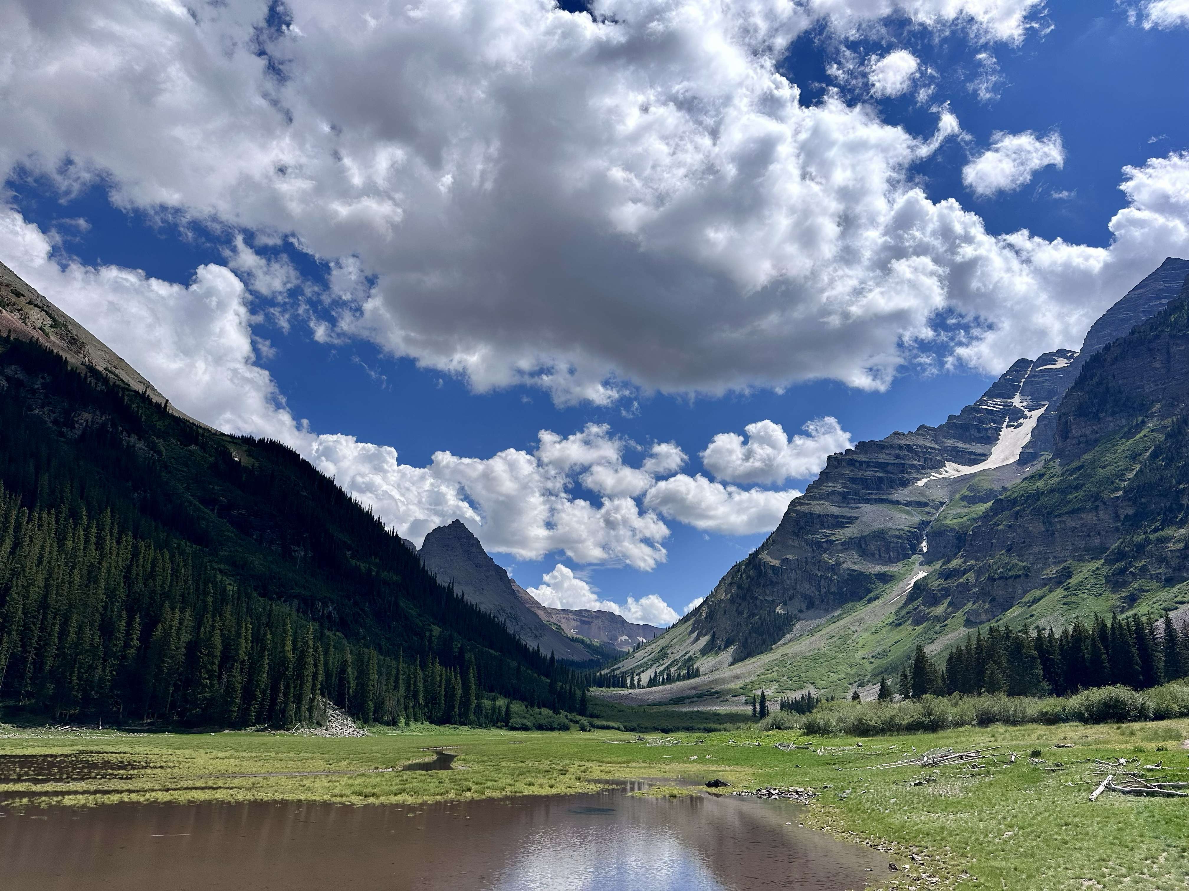
The Hike: We stayed in Crested Butte the night before and Debbie drove Erin and me to the West Maroon Trailhead. It was a busy parking lot with both private cars and a couple shuttles. Not everyone was doing our hike, the TH also serves access to the rest of the Maroon Bells-Snowmass Wilderness. After we left the parking lot we didn't see but a handful of hikers until we got near the pass. The TH is at 10,400 and the first 2.5 miles stays below 11,000 feet. The trail is uphill but gradual through a "meadowed valley. It was July and the wildflowers were abundant. The skies were already gray and now we could see rain coming down the valley. We geared up and kept hiking. The rain was short lived and as we neared the N. Fork Crystal River junction it was gone. The valley behind us was green and lush.
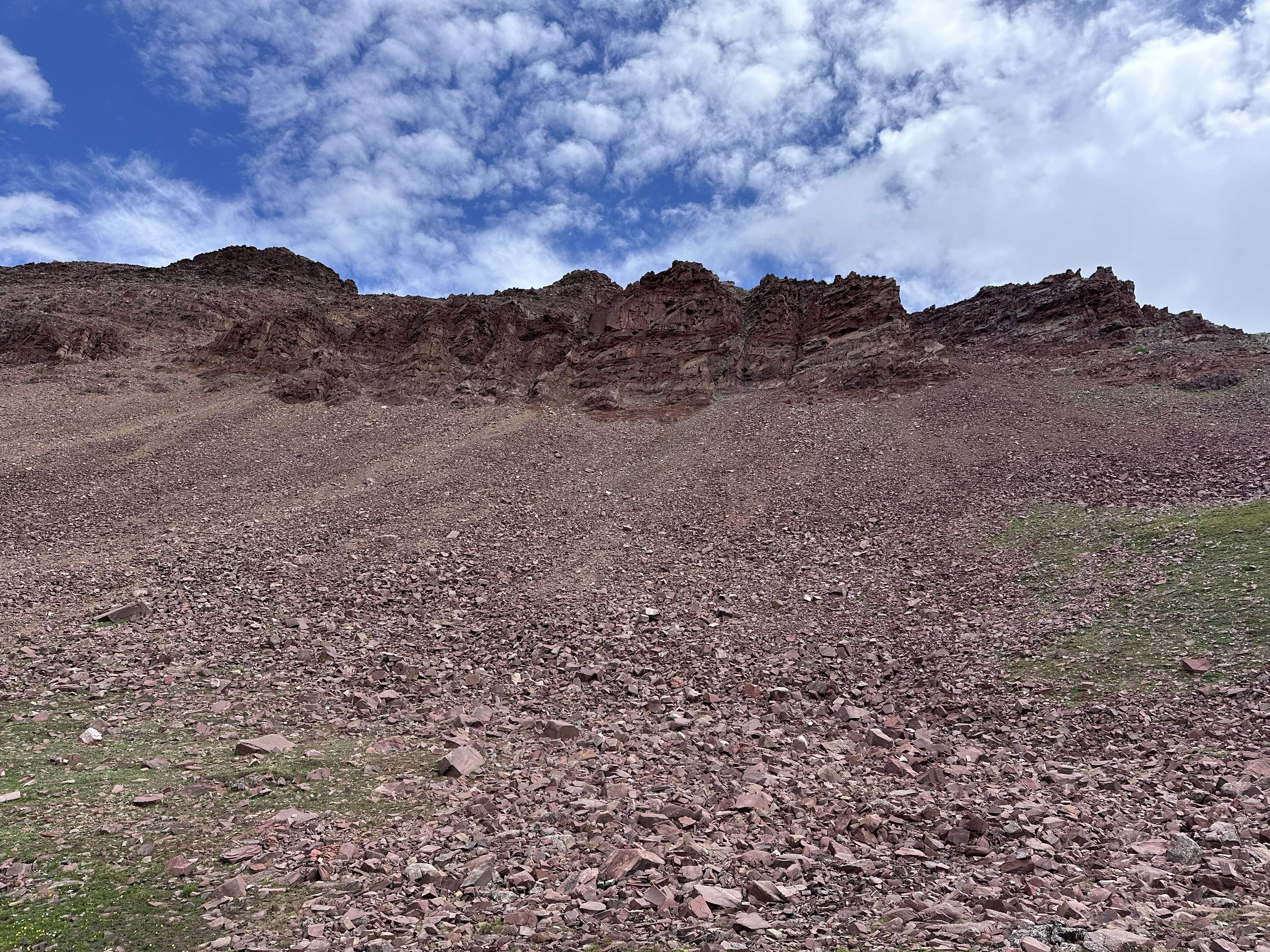
At the N.Fork junction the red rocks on the ridge above us became more prominent. The rocks in this area, including the Maroon Bells, are Pennsylvanian-Early Permian age clastics (sedimentary rocks made of distinct eroded particle like claystone, siltstone and sandstone). They are red due to oxidized iron and friable (they break and crumble). They are about 310 million years old laid down as the Ancestral Rockies were uplifting. This uplift was not related to the Larimide orogeny that formed the Front Range and other ranges. However, the red rocks of Red Rocks Amphitheater were deposited during the Ancestral Rockies Orogeny but from a different mountain range than the Bells.
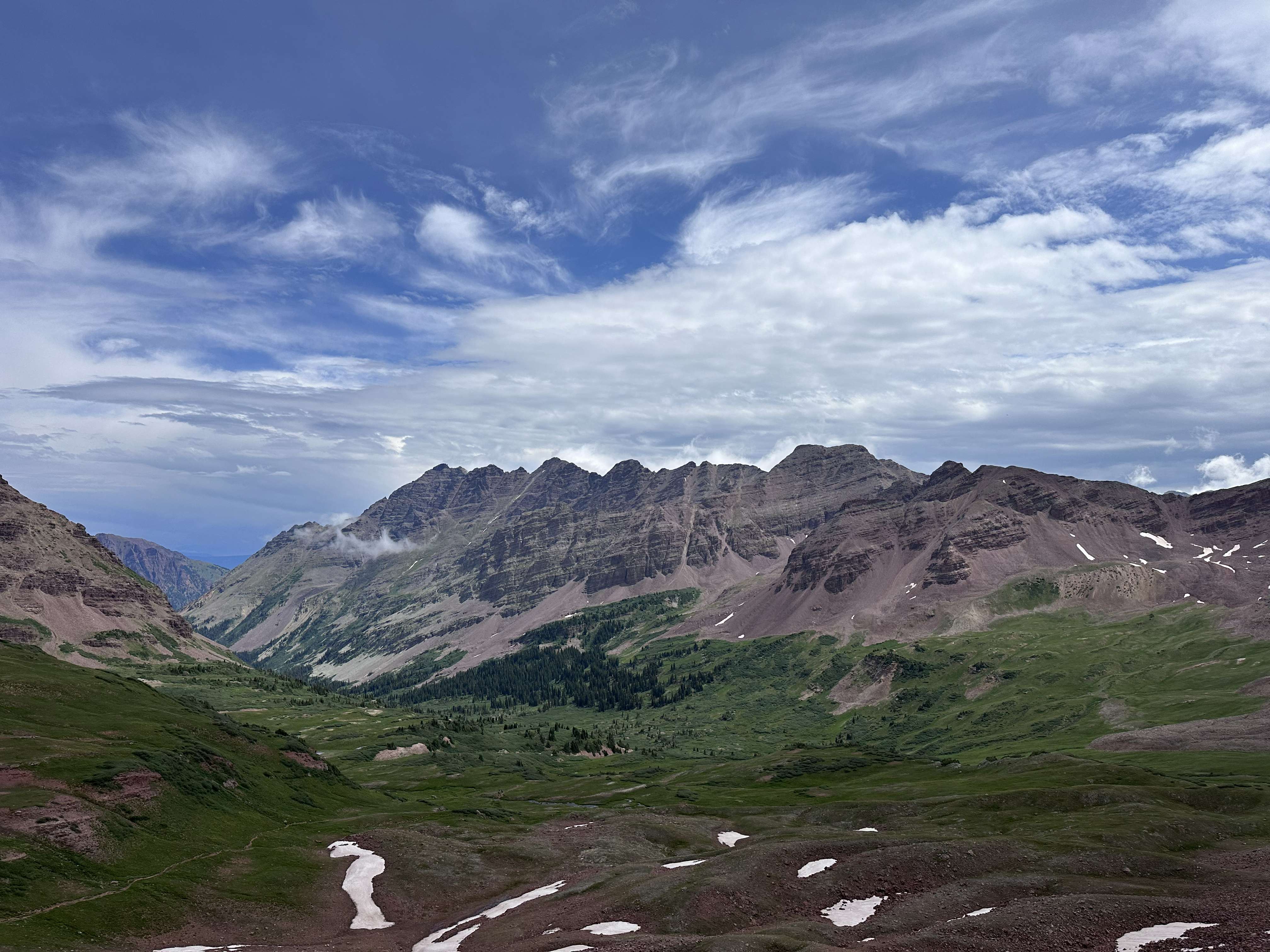
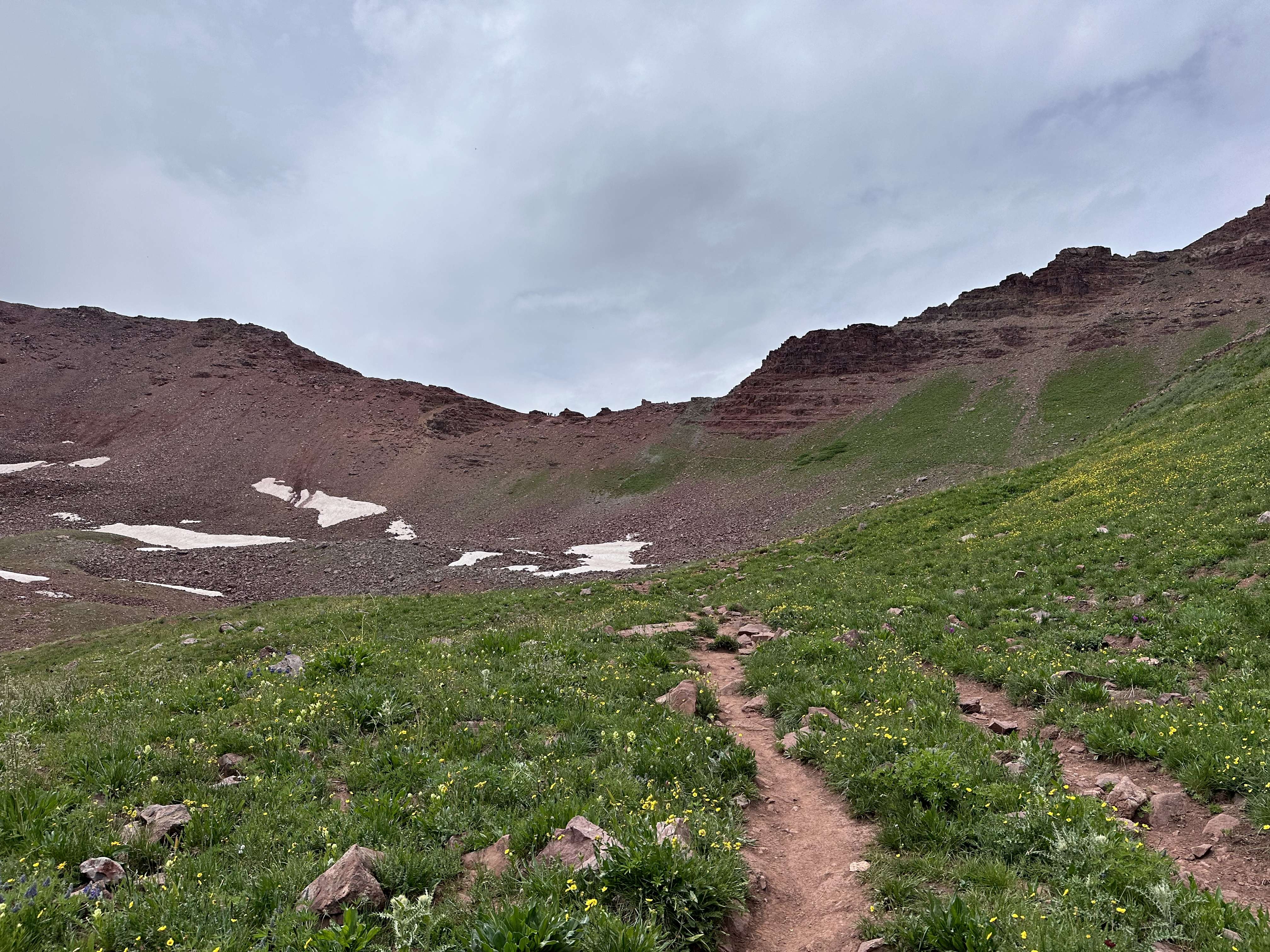
West Maroon Pass is 12,500. It is about 4 miles from the trail head after a 2,000 foot climb. The pass was a busy little place with hikers coming from Aspen, hikers going to Aspen, and some on the 27 mile four pass loop. Some were through hiking like us, others were dayhiking in and back. The trail up to the pass is a big switch back but not too steep. The east side it is narrow and gravelly at the top but flattens out after a few hundred feet. Looking back you can see people on top.
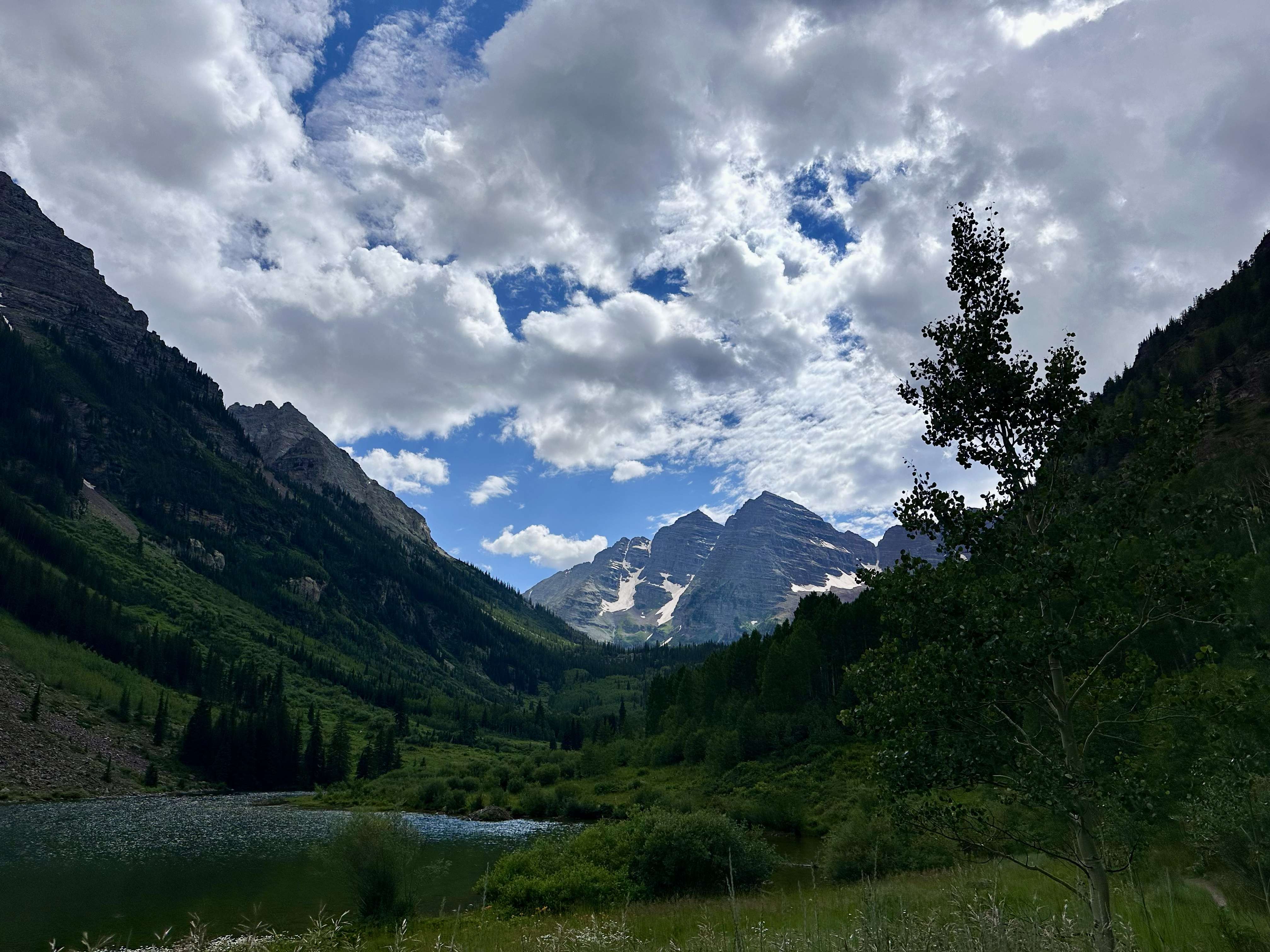
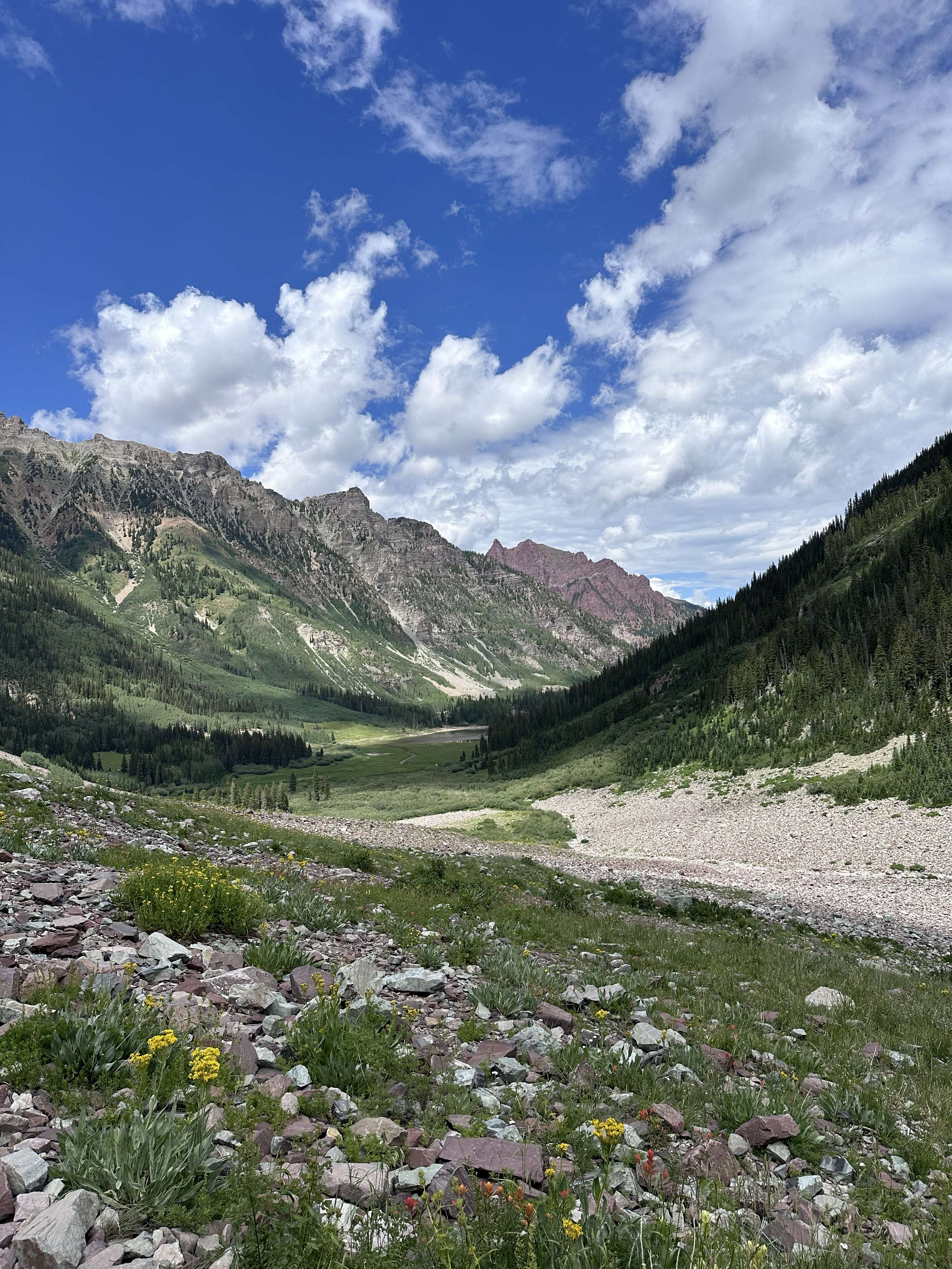
On the other side of the pass you can see the pyramidal peaks that this area is noted for. In the fore ground is the valley floor that the trail follows. About 2 miles from the pass the trail cross to the east side of West Maroon Creek. 0.8 miles further, it cross back to the west side of the creek. Both of these were wet crossings for us. It was rocky but we had poles and water shoes. Soon the trail moved up the side of the valley floor and Crater Lake came into view. At Crater Lake, be sure to turn around and take in where you have been. From here it is less than two miles to Maroon Lake and a chance to see the classic view of the Maroon Bells.
The last part of the trip was by shuttle. There is a concrete shelter by the road where you can wait out of the weather. We had reservation and got on the first bus to come by. It was pretty crowded and Erin and I had to stand for the 30 minutes or so it took to take us to the Aspen Highlands Ski Resort. While we hiked, Deb drove County Road 12 over Kebler Pass to Colorado 133 and then north to Carbondale to get to Aspen so she could pick us up at the ski resort. She said 12 was rough but passable. It was late in the afternoon and we didn't want to drive back to Denver so we stayed in a hotel in Basalt.
To Buy Maps: The entire trail is a two map set. Color, 11x17 maps on weatherproof paper are available for $5 each ($10 for the set) plus S&H by emailing Charlie at cew5151@gmail.com (copy and paste in your email).